Driving the Beartooth Highway: A Guide
Driving the Beartooth Highway is an incredible experience, and one that highlights some of the most spectacular scenery in both Wyoming and Montana.
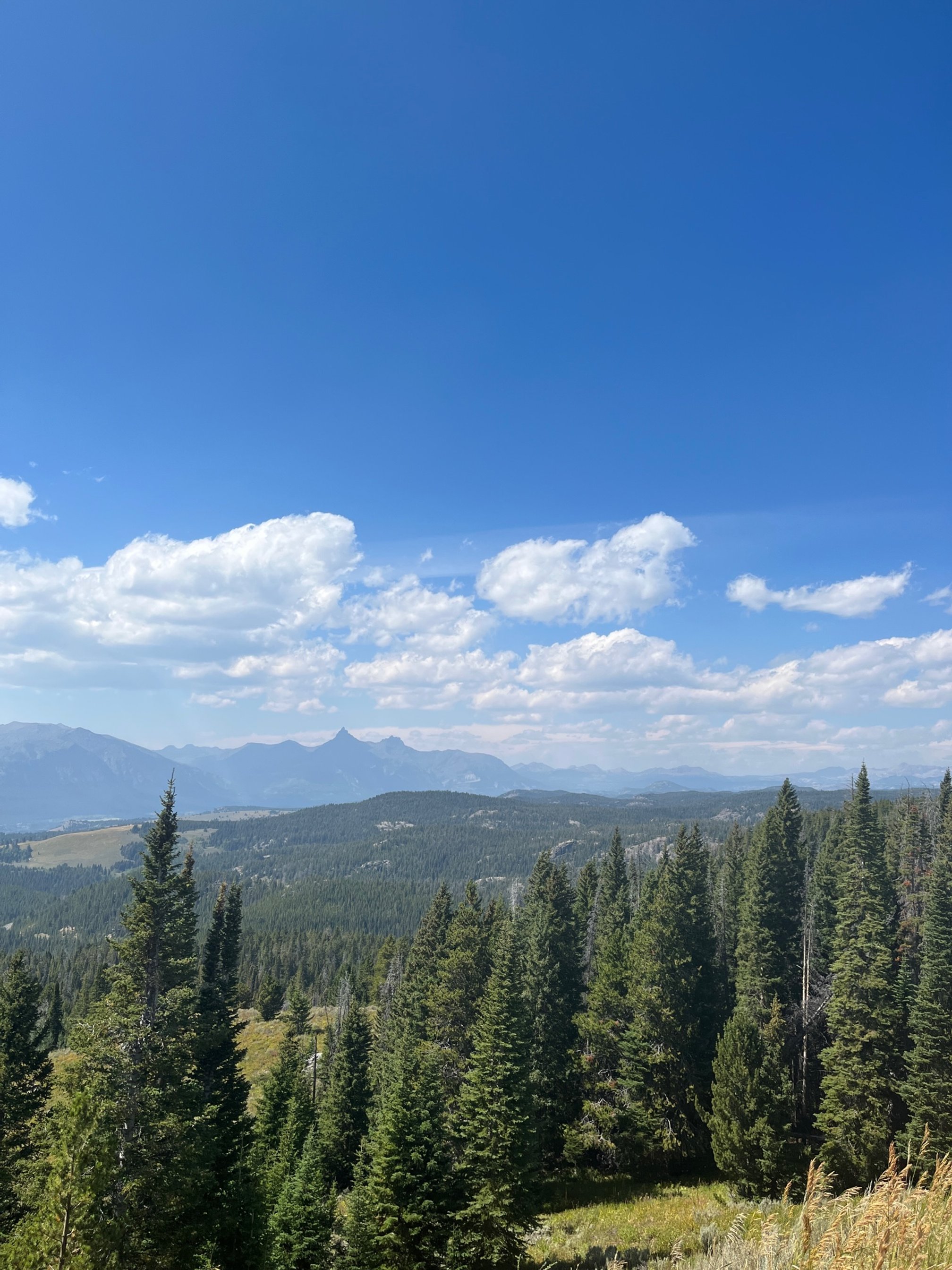
You’ll slowly ascend through lakes and lodgepole pines into an alpine tundra filled with with glaciers and long range views.
In this guide, you’ll learn everything you need for a successful day trip on the Beartooth Highway from the best stops along the way to driving safety tips.
If you’re traveling Beartooth Highway with kids, there are plenty of areas to get out and stretch your legs. Kids will also be amazed at the rugged mountains, year round glaciers, and unique ecosystems along the way.
I think this is one of the best day trips from Yellowstone National Park, and I highly recommend it to your family on your next trip to Wyoming!
Beartooth Highway switchbacks heading back to Island Lake
This post contains affiliates. If you purchase through the links below, I will earn a commission at no charge to you.
Where is the Beartooth Highway?
Beartooth Highway begins in Cooke City, Montana, just outside of Yellowstone National Park’s northeastern entrance. [NOTE: For more information on the different Yellowstone entrances, including what to do at each, check out my complete guide!]
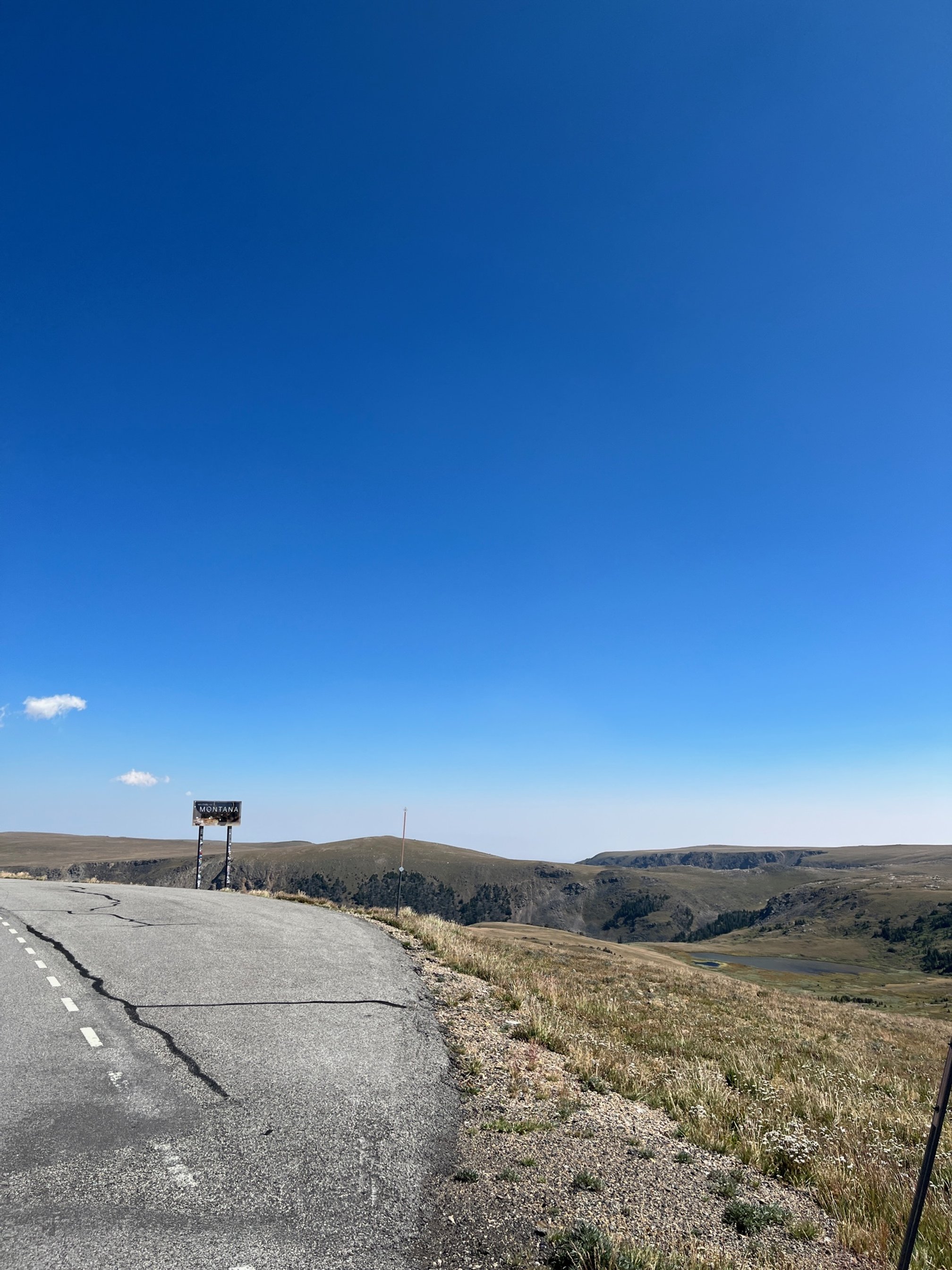
It dips back into Wyoming for about half of its length before heading north to end in Red Lodge, Montana.
The entire route is a little less than 70 miles one way, but you should plan for at least a few hours.
You’ll want to make stops to soak in the beauty, and this route could easily take a half day or more, depending on how long you linger along the way.
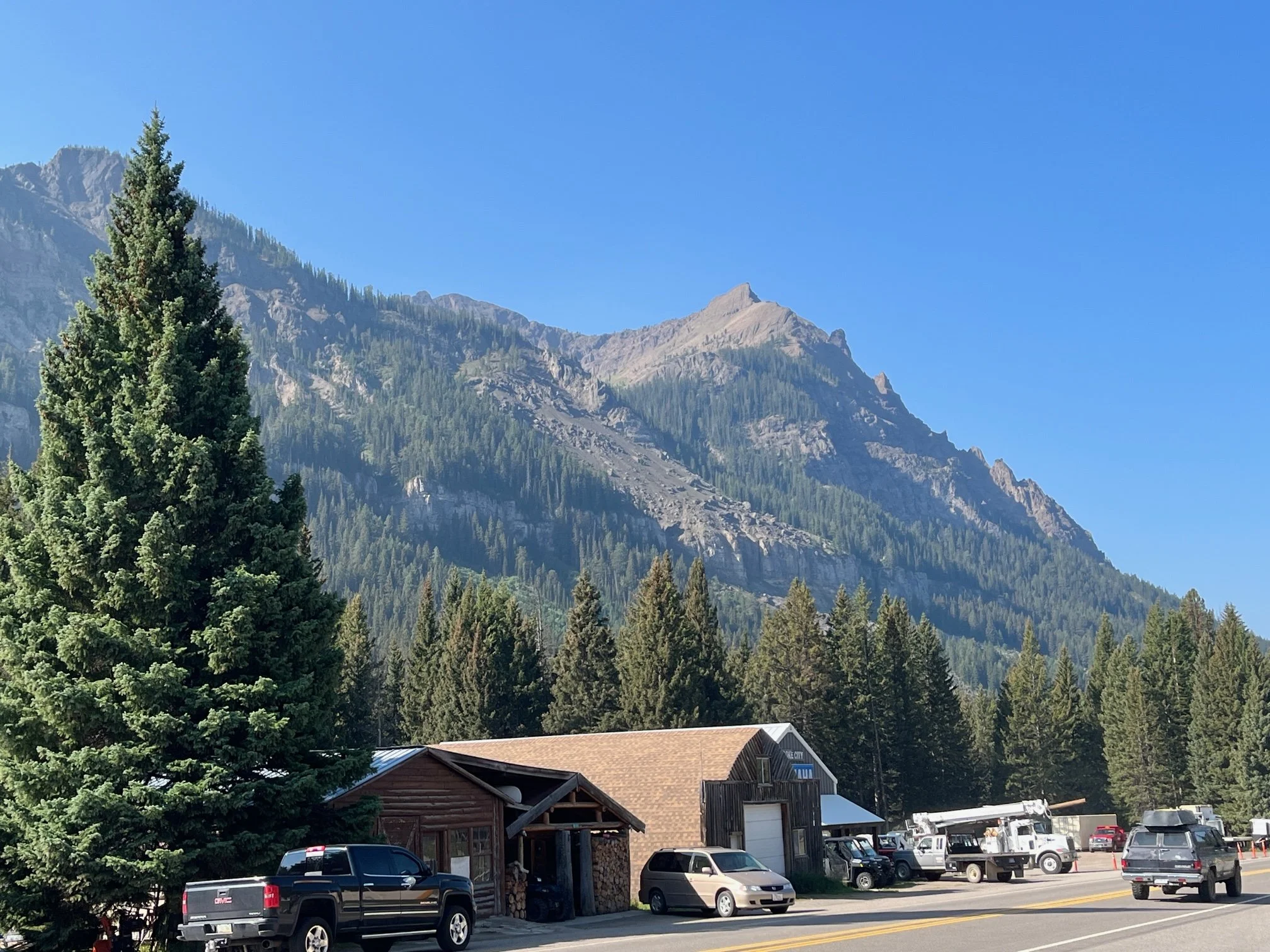
Cooke City on the western end of the Beartooth Highway
Why is it called the Beartooth Highway?
On this route, you’ll travel through the Beartooth Mountains, Custer Gallatin National Forest and the Absaroka-Beartooth Wilderness.
About halfway between Cooke City and Red Lodge is a distant mountain with a jagged, highly pointed peak. This is Beartooth Mountain, and it is what gives this highway—and other features—the name.
Keep a look out for that mountain as you travel along. If you’re traveling from Cooke City, Beartooth Mountain will be on your left after a series of steep switchbacks as you climb from Island Lake.
If you make it to the Beartooth Basin Summer Ski area, you’ve gone too far.
There is a small turnoff for the Beartooth overlook, but it has a bit of an dip when you’re entering from the road. The turn off also comes up quickly, so be prepared.
The stops below have been organized going from the Cooke City end of Beartooth Highway to the Red Lodge end.
Want to see how a Beartooth Highway drive will fit into your Yellowstone itinerary? Check out my 10 Days in Yellowstone post!
Places to Stop along the Beartooth Highway
The Beartooth Highway can be a bit intimidating for drivers who live in less rugged areas, but I would still encourage you to try it out.
Keep in mind that the drive ascends more than 5,000 feet along the way, and, at its highest point, you’ll be more than 1,000 feet above the tree line in alpine tundra.
It’s truly a drive like none other, and you’ll want to go slowly (literally and metaphorically) to have the best experience.
If you’re hesitant about the logistics of driving here, I’ve included some helpful hints in the section below this one to prepare you for your time exploring Beartooth Highway.
Lake Creek Falls with Historic Bridge
Located on the Cooke City end of the highway near the Clay Butte Lookout, this small waterfall is worth a quick stop.
There’s a dedicated but small parking area for this stop, but you will need to cross the road to get to the falls.
You’ll be able to walk across the original bridge that used to service this part of the highway.
You can see the falls from the road, but you’ll want to spend more time than that here!
Index Peak and Pilot Peak Overlook
You’ll find this overlook on a curve close to Cooke City, and just below the Wyoming-Montana state line on the western end of the highway.
On a clear day, you’ll be able to see the distinctive Index Peak and Pilot Peak from the gravel parking area.
There are permanent information boards with helpful directions on identifying those peaks and other, smaller ones.
There’s also information about the local wildlife that you might see along the highway.
Top of the World Resort
Top of the World stays open year-round, even with the Beartooth Highway is closed to cars during the winter (you can access it by snowmobile!).

The gas pumps and store at Top of the World Resort
There are cabins and hotel rooms on the property along with ATV rentals. They also have a few RV spots if you’d prefer to use this as your base to explore this area.
In the store, you’ll find all sort of souvenirs: can koozies, t-shirts, local history books, jewelry, Native American crafts, and kids toys.
There are also a limited supply of drinks and snacks, making it the only place outside of Red Lodge or Cooke City to get any food.
You’ll also find one of 2 bathrooms available on the Beartooth Highway. There are vault toilets near the parking area.
If you’re low of fuel, Top of the World is the only place on Beartooth Highway to get gas once you’re out of Red Lodge and Cooke City.
Island Lake

The beautiful Island Lake from the shore near the boat launch
If you need a place to stretch your leg with a beautiful view, Island Lake is the perfect stop.
Park at the boat ramp at the back of the property, and explore the edge of the lake on foot.
If you’ve brought your kayak or canoe with you, you can launch at the boat ramp and see this gorgeous spot from the water.
There’s a first come first served campground here, too, if you’d like to extend your stay.
>> Read our full Island Lake Campground review here. <<
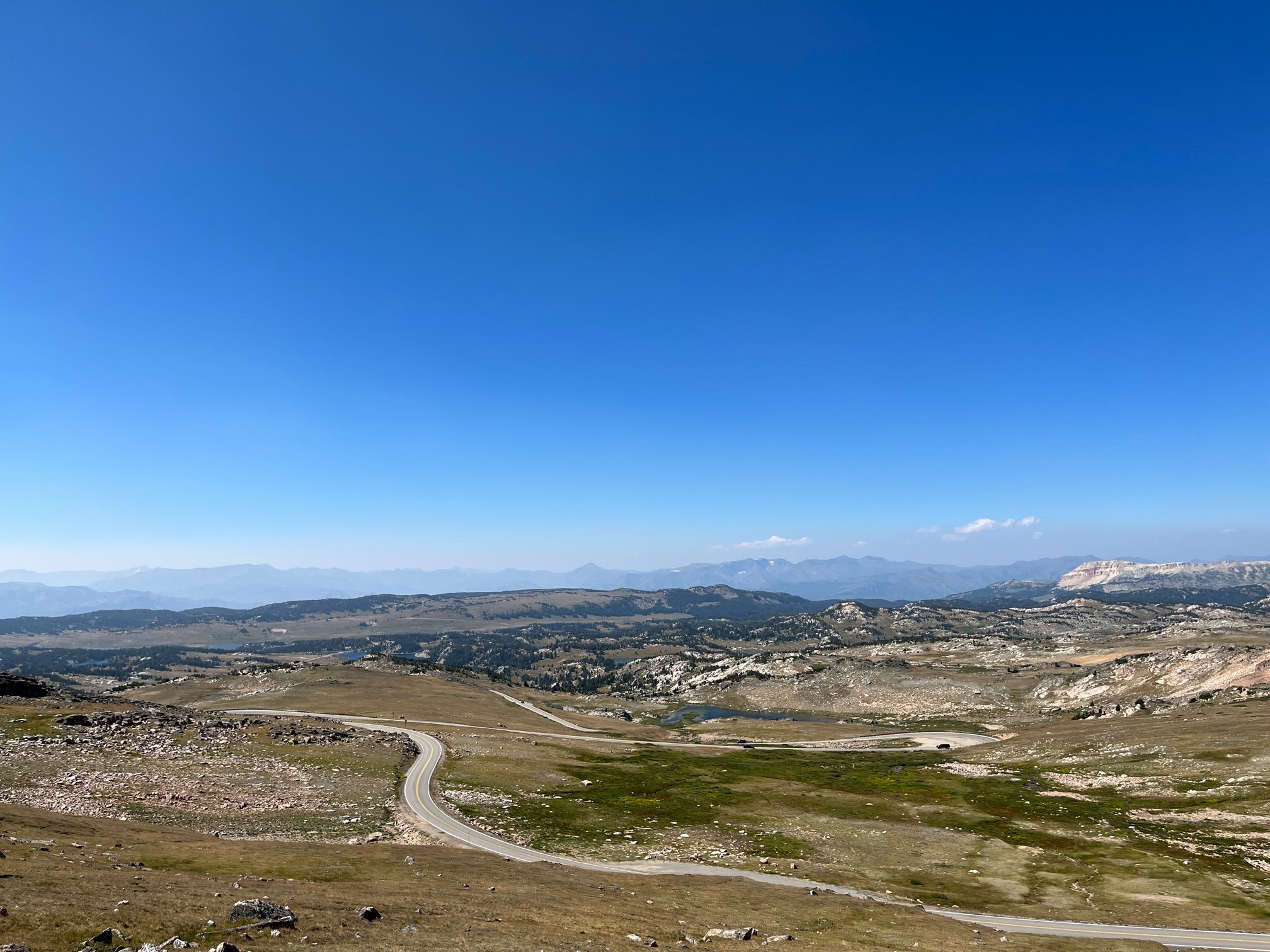
Beartooth Pass Vista
This is the highest point on the highway, so it’s worth stopping here for just that reason.
On a clear day, you’ll be able to see the Beartooth Mountain from the edge of the parking area to the left as you enter.
Unlike some of the other overlooks, you’ll need to get out of your car and walk around to check out the views.
Because of the elevation, the weather can change quickly up here, so don’t put this overlook off if the weather is nice on your first pass.
NOTE: While Beartooth Highway is paved, the road to the parking area at Beartooth Pass Vista is gravel. When entering that access road to the parking area, there are several deep holes where the gravel has worn away. Use caution to avoid damaging your tires or undercarriage.
For views back towards Island Lake and Cooke City, I found that the roadside pullout across the street from the entrance to Beartooth Pass Vista offered better scenery.
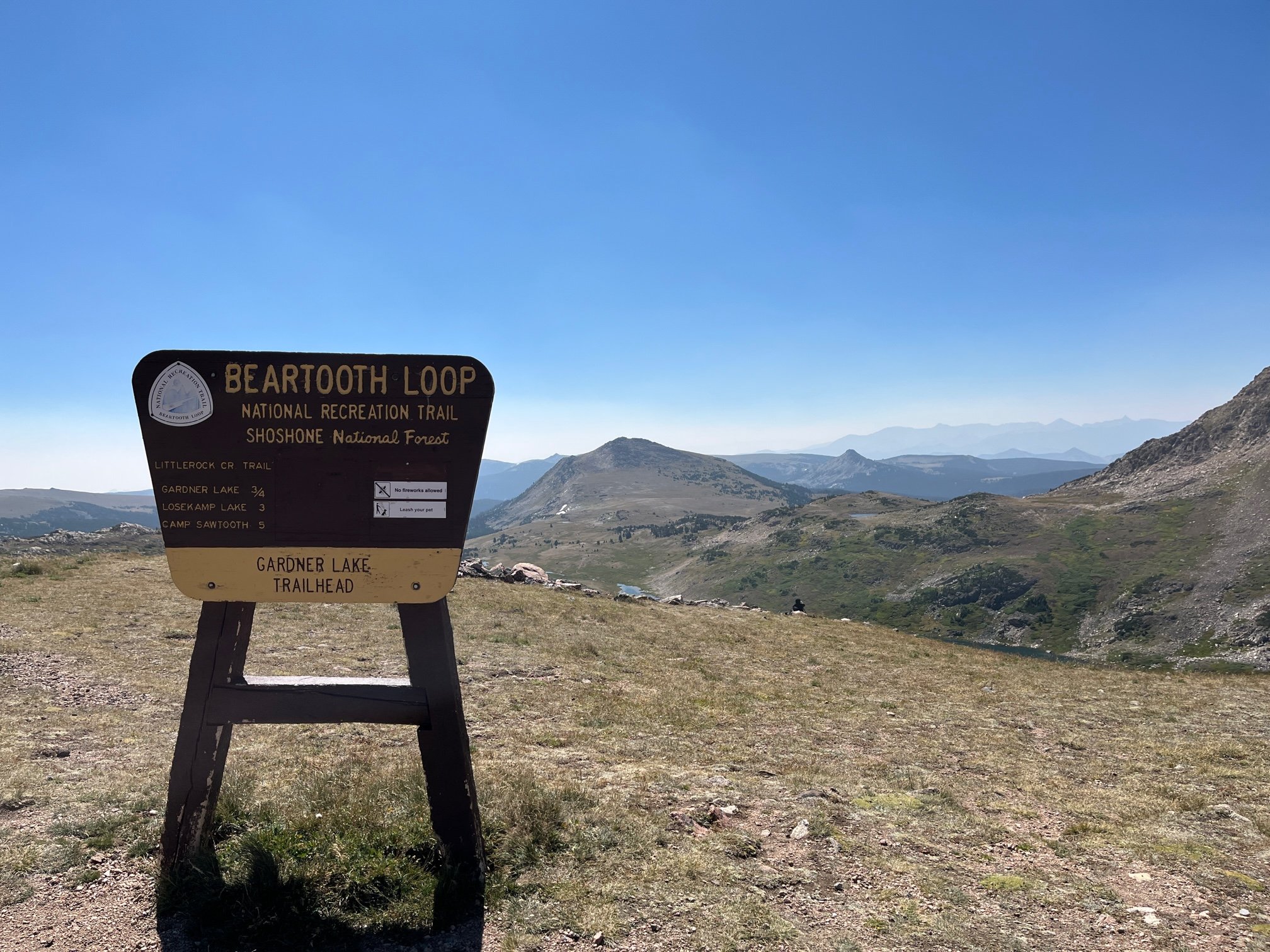
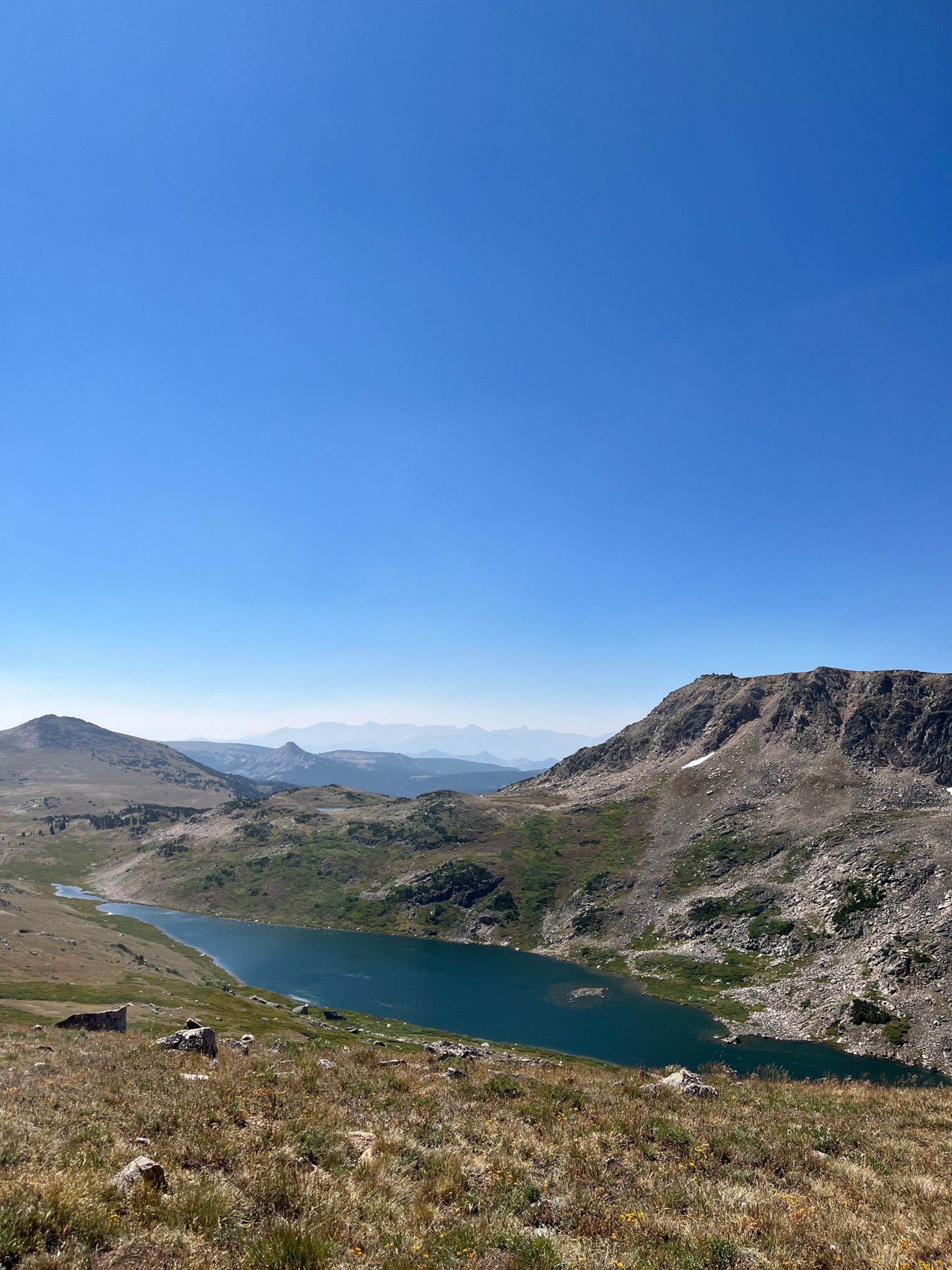
Gardner Lake Overlook

The Camping Kiddos are really selling that view!
I found this overlook to be even more beautiful than the titular Beartooth Pass Vista.
From the gravel parking area, you get incredible long range views of Gardner Lake below and the Beartooth Mountains beyond.
There’s also a short trail from the parking area (about 1.6 miles) that will take you from the parking down closer to the lake.
The kids and I did a portion of this trail, but it was incredibly windy and cold on the day we visited, which wasn’t ideal for their enthusiasm.
If you do take it on, keep in mind that there’s almost 600 feet in elevation loss on the way down, which makes for a steep ascent.
The trailhead isn’t super well marked, but there’s a distinct, narrow trail in the grass to the left of the large Gardner Lake sign in the parking area.
Rock Creek Vista

The Camping Kiddos and I at the Rock Creek Vista
You could’ve called this “Chipmunk Overlook” and still have an accurate name as there are SO MANY chipmunks here.
And, note, these little chipmunks are adorable, but they are also nearly fearless of humans. We saw several people feeding the chipmunks while we were there. Don’t do this, folks.
Other than that, this overlook is a must do. Plus, there are toilets, one of the few opportunities on the highway to use the restroom.
There is more parking here than at most of the overlooks, and it is the most built out of the overlooks.
To get to the best views, you’ll walk on a stone and concrete path along the ridgeline of a mountain to get to Vista Point Observation Point.
Here, you’ll find 270 degree views of the Beartooth Highway and surrounding mountains.
Tips for Driving the Beartooth Highway
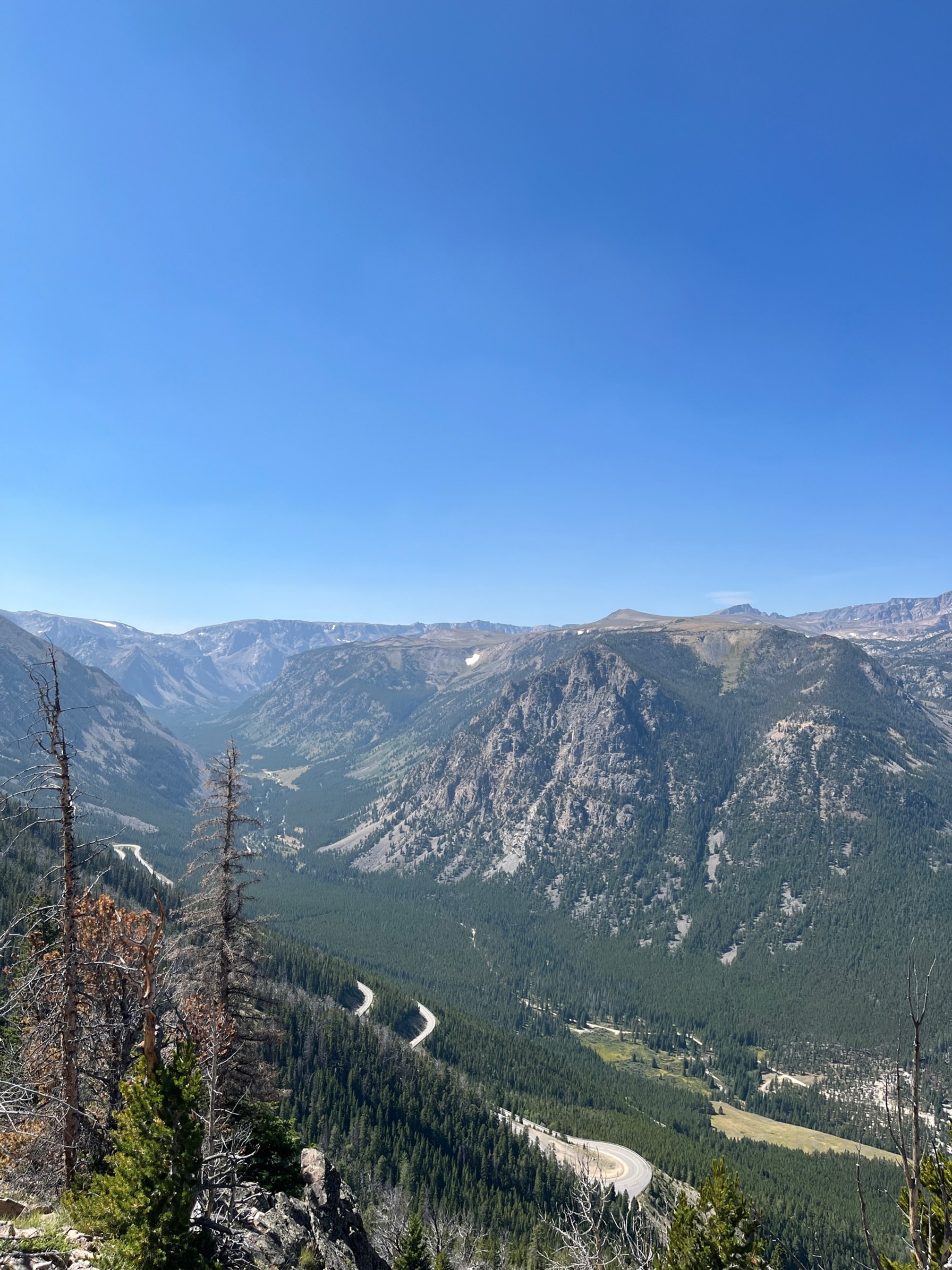
The road from Rock Creek Overlook to Red Lodge, Montana
Did you know that journalist Charles Kuralt once called Beartooth Highway “the most beautiful drive in America”?
While I haven’t driven every road in the country yet, I have seen a lot of them, and Beartooth Highway is easily in the top 5 most beautiful places in the U.S.
In fact, the craggy, snow topped mountains reminded me of the German Alps—so this is a great (and cheaper) alternative to going to Europe.
However, Beartooth Highway isn’t like other highways. It twists and turns so much that it feels as if its switchbacks have switchbacks. (It’s still not as bad as the intimidating Million Dollar Highway in Colorado!)
You’ll feel at times as if you’re going to fall off of the road down into nothingness—and there are often no guardrails.
Hesitant drivers might read that and think, “no way!”
But I’m here to assure you that anyone can have a successful trip down Beartooth Highway with a little preparation.
Check the weather.
This is a non-negotiable. The weather can, and will, stop your trip from happening in a myriad of ways.
First of all, the highway is only open during the warmer months as it is literally impassable during the winter.
You’ll see just how high the snow gets on this lonely stretch of road from the guidepoles on both sides at regular intervals.
While the bulk of the snow comes between November and March, snowstorms can happen just about anytime during the year here when conditions are right.
I wouldn’t head on on this trip if rain or snow was forecasted that day. Both will ruin visibility (and the views are what you’re here for), not to mention make the entire drive much more treacherous.
You should also check to see the fog forecast, which is another consideration. Fog does add to the danger of the drive, and it obscures those gorgeous views you’re chasing.

On the alpine tundra section of the Beartooth Highway, where you’re more than 1000 feet above the tree line
Fill up on gas.
This is no time to test the limits of your gas tank.
Fill up in Cooke City if possible. Your other last minute option for gas is at Top of the World, which is a convenient but pricey fill-up.
If you don’t have enough gas to make it to Red Lodge, you’re out of luck.
For much of the drive, the shoulder is limited or non existent, so you’re facing the prospect of coasting to whatever patch of gravel is available.
And then you have the unenviable task of getting some gas—either by flagging down a passerby who might have an extra can, or by calling up AAA or similar (if you have cell service).
There are limited facilities.
On the entire route, you’ll only find one overlook with a restroom. The only restrooms on the Beartooth Highway are at the Rock Creek Vista overlook. These are vault toilets, but they are clean and well maintained.
The only other option is at Top of the World between Beartooth Lake and Island Lake. These are also vault toilets, but seemed a bit less maintained than those at Rock Creek Vista.
Once you’re out of either Cooke City or Red Lodge, there isn’t any food to speak of, either.
Bring your own drinks and snacks since you’re likely going to spend a few hours exploring along the highway.
Use the GuideAlong app.
The tours offered on this app are excellent while being reasonably priced.
We loved our Yellowstone and Grand Teton National Parks tour bundle so much that we immediately bought the Beartooth GuideAlong tour, too.
NOTE: You’re don’t need cell service while using the tour, but you WILL need wifi to download the tour. We didn’t have cell service at Roosevelt Cabins in Yellowstone, so we had to stop at the Cooke City visitors center to download it.
Once we had wifi, the tour downloads in just a few minutes.
We love these tours since they begin automatically when we pass a point of interest. You’ll learn about the history, geography, and geology of the Beartooth Highway as you drive along.
When traveling with kids, it’s particularly nice to have a tour that we can start, stop, and replay if the kids missed something or were talking.
Go slowly.

You’ll see glaciers year round along the highway.
First of all, you don’t want to miss anything as literally every mile of this highway has beautiful views.
Secondly, the road is tight with limited—and often non-existent—shoulders. In places, there aren’t any guide rails, either.
Additionally, the wind can gust at 25 miles per hour (or more!), which makes this drive feel more treacherous.
The speed limit for most of the highway hovers around 45 MPH, with some areas dipping down to 35 MPH or even 25 MPH on some of the tightest curves.
Clearly, the road isn’t designed for high speeds, so slow down and enjoy the experience.
People who are also on the highway are generally cautious and don’t tailgate. If you do get someone who is feeling anxious and needs to pass you, there are several areas that you can pull over to let others pass.
Consider your vehicle.
The road works well for standard vehicles and motorcycles, but I would caution against bringing large RVs or trailers down this road.
Not only is the road going to be uncomfortably small for those larger vehicles, you’ll also have to consider the sometimes intense switchbacks, which can put significant strain on your RV or tow vehicle’s engine and breaking system.
On windy days, those larger RVs and campers are going to feel the wind much more than a regular car, SUV, or motorcycle, which can add to the treacherous feeling of this road.
Final Thoughts on Driving the Beartooth Highway
This highway was a highlight of our trip to Wyoming and Montana, and it was an excellent day trip from Yellowstone National Park.
In fact, if you have an extra day on your Yellowstone family vacation, I highly recommend adding this drive in.
Cooke City, the western end of the Beartooth Highway, is just outside of Yellowstone’s northeast entrance and less than an hour from Tower-Roosevelt and the Roosevelt Cabins.
From Tower-Roosevelt through Cooke City and into the Beartooth Highway, the scenery changes dramatically. It’s fascinating to see the different ecosystems along the way.
Even though there was a lot of car time, my kids enjoyed this day trip immensely thanks to the many stops and beautiful scenery.