16 Best Hikes Near Charleston SC
Get outdoors in the beautiful Lowcountry to enjoy the best hikes near Charleston, SC!
I’m a Charleston native, and I’ve explored every corner of the Holy City and beyond.
If you’re looking for some great hikes for kids and for beginners, you’re spoilt for choice here as nearly all of the trails in Charleston are very, very flat. (Perk of living at sea level!)
Here are the trails that my kids and I have visited again and again.
So, take a break from eating at all of the amazing restaurants and visiting all of the historic sites, and get out into the natural beauty of Charleston!

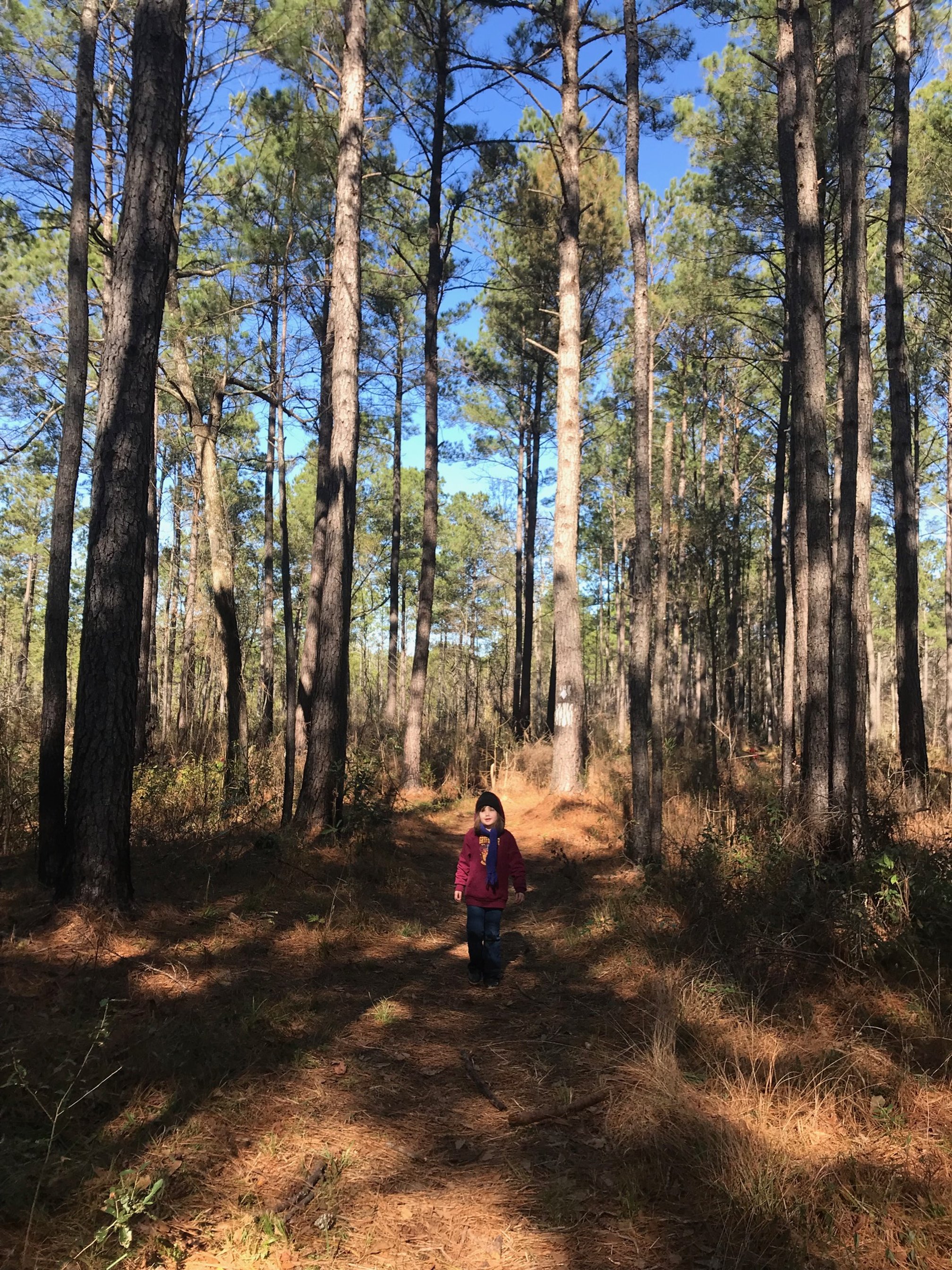
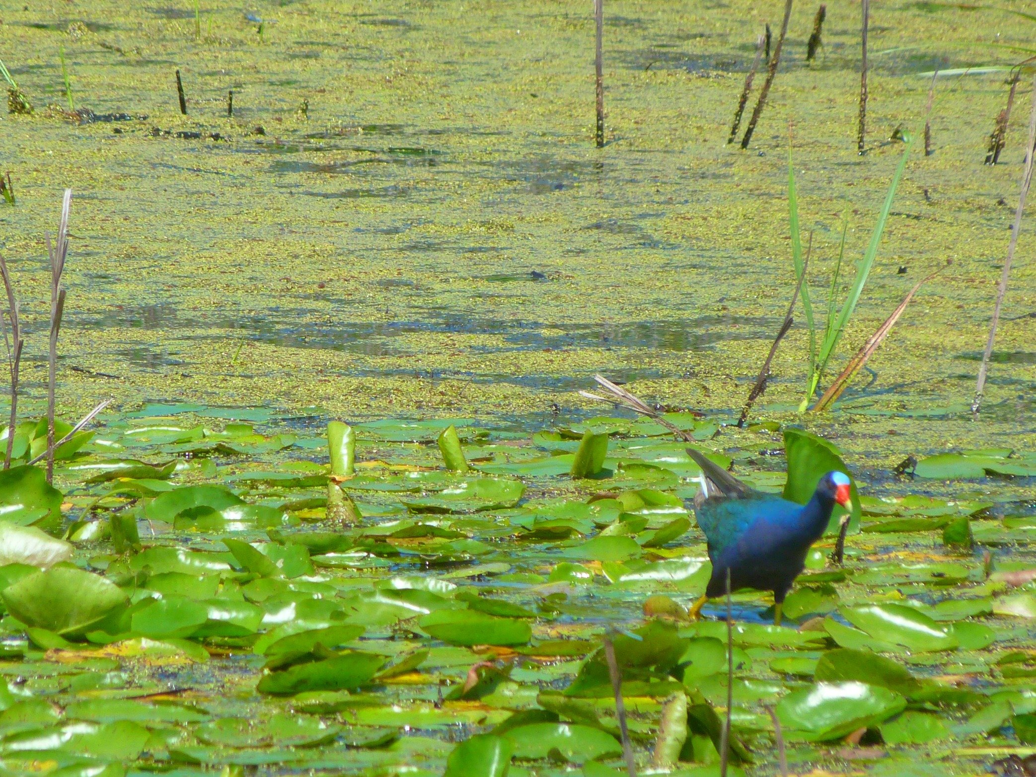
My daughter hiking at the Sewee Visitors Center in Awendaw
Is There Hiking in Charleston?
If you’re visiting Charleston for the first time, or if you’ve recently moved to the area, chances are that you’re thinking I’m crazy for writing a post about hiking in Charleston.
After all, isn’t Charleston known for its beaches and waterways—and not its hiking?

PIN ME!
While the water does get all the glory here (and rightly so), there are many opportunities to hike in the areas surrounding Charleston.
While Charleston doesn’t have the dramatic mountain views or the waterfall hikes that other parts of South Carolina do, there are still many reasons why you’ll love hiking in this area.
First of all, not everyone has a boat—or wants one—but you still might want to see that beautiful water.
I’ve got several suggested hikes below that will allow you excellent access to those picture perfect views of harbor and marsh, no boat required.
Secondly, getting out into nature at your vacation destination is an excellent way to get to know that area.
Finally, you’ll probably need a hike or two after you’ve eaten at the amazing restaurants in Charleston!
My personal favorites: Halls Chophouse, Vicious Biscuit, Page’s Okra Grill, and Ted’s Butcherblock.
So, throw all of your kids’ hiking gear into your family’s suitcases and let’s get out onto the trails in Charleston.
The Best Hikes Near Charleston (including a Few You've Never Heard of)
If you look through the Google results for “Hiking in Charleston,” you’ll find a lot of the same suggestions.
Why is this?
Because these other writers and bloggers aren’t from here.
I’ve spent more than 3 decades living in and exploring my hometown of Charleston, SC, and nearly a decade doing so with my kids, so I know all the hidden hiking spots that visitors don’t.
Below, you’ll find a great mix of visitor favorites and hidden gems so your outdoor family vacation will be packed with plenty of hikes.
I will note that these hikes are much more comfortable when the weather is cooler. They made my list of the best things to do in Charleston in winter!
TIP: Before you set out on any hike, it’s a good idea to check for any recent updates at AllTrails to ensure that it is open and ready for hikers.
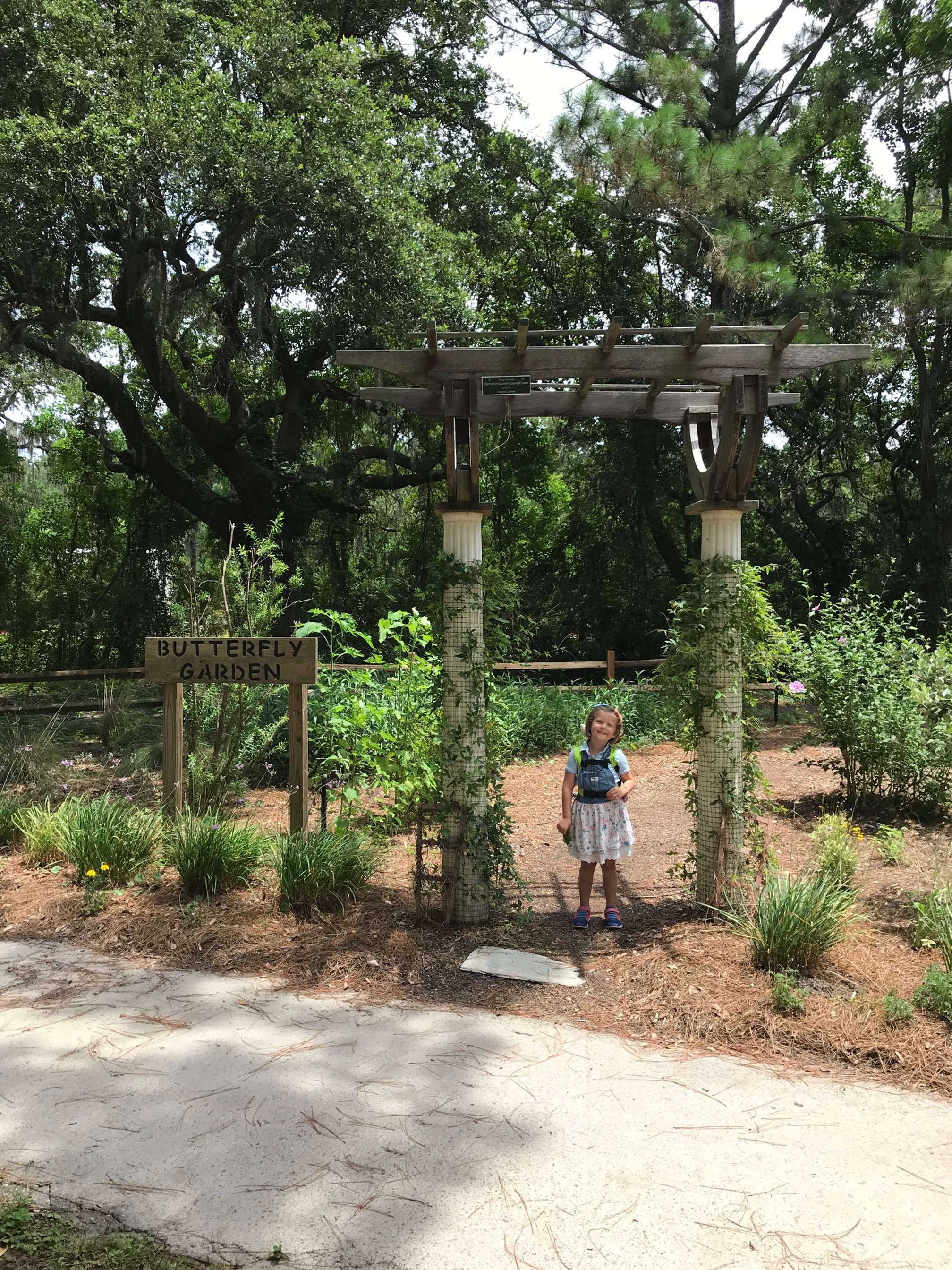
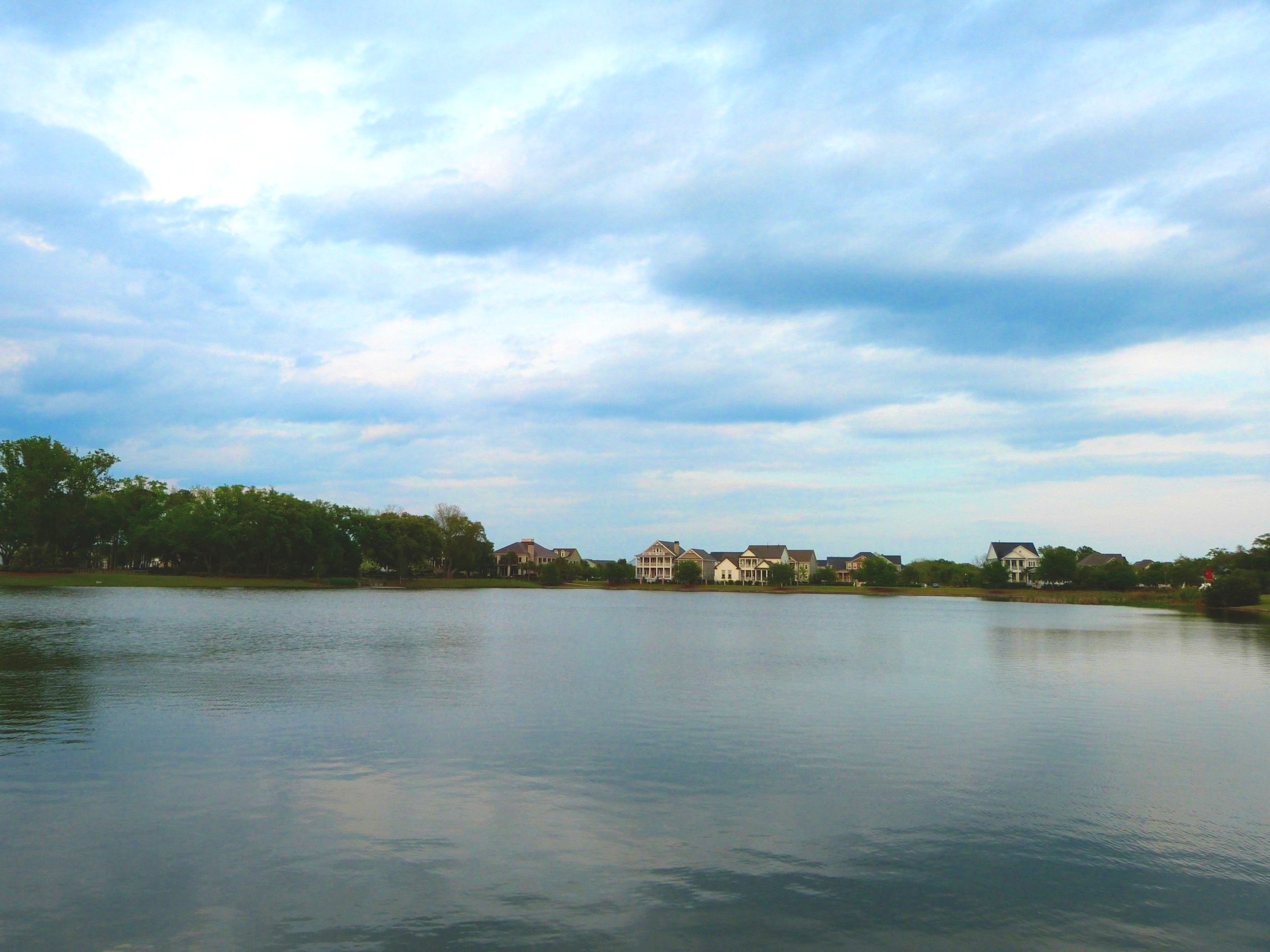
Marsh View Trail, Mount Pleasant
Location: Trailhead is behind the Mount Pleasant Waterworks building on a small road perpendicular to Rifle Range Road. Go between the Waterworks Building and the school parking lot, and follow the road to the dead end. Trailhead is marked, but not well. Look to the right in the pine trees at the end of the road.
Parking: Parking is free. Park anywhere along the small road next to the trailhead.
Cost: Free
Length: 0.3 miles
Difficulty: easy
This adorable little trail is perfect for families with young kids or hikers who want to get an unspoiled look at a Lowcountry marsh.
As more and more development comes to Mount Pleasant, these pockets of green space are getting few and far between.
However, the Town of Mount Pleasant has dedicated a wonderful space off of Rifle Range Road to the community.
On this 0.3 mile trail, you and your family can wander along a paved trail through a maritime forest.
At the end is a stunning view of the marsh that stretches unobstructed all of the way to Isle of Palms.
Don’t forget to visit the small butterfly garden on your way out!
Laurel Hill County Park, Mount Pleasant

Hiking around the Yellow Loop in Laurel Hill County Park with friends
Location: Laurel Hill County Park covers a large area in Mount Pleasant, but the only daily trailhead access is through the Mount Pleasant Recreation Complex inside of the Park West subdivision. After turning off Park West Boulevard into the complex, follow the road past the track and to the soccer fields (at the back of the complex). The trailhead is in the woods between the furthest soccer field and the furthest baseball field. See this map for more detail.
Parking: Parking is free at the Mount Pleasant Recreation Complex.
Cost: Free
Length: various (up to 4.8 miles)
Difficulty: easy
While this county park is between busy Highway 41 and one of Mount Pleasant’s largest subdivisions (Park West), you’d never know it once you’re on the trail.
While the trailhead can be tricky to find—see notes above—its worth the effort.
There are multiple trails to explore on the site of an old plantation, but the 2 that I recommend are the Yellow Loop and the Orange Loop.
Yellow Loop at Laurel Hill County Park
The Yellow Loop is an easy, flat, and gentle 1.7 mile hike that takes visitors along a wide unpaved path in the pine forest.
While there aren’t any major views or overlooks on this path, you’re likely to see plenty of local wildlife including white-tailed deer, snakes, raccoons, armadillos, owls, and more.
Orange Loop at Laurel Hill County Park
The Orange Loop covers the heart of the park with a large but still easy 2.2 circuit.
This trail covers nearly the entirety of the Yellow Loop while also adding in meadow views, a creek crossing, and a glimpse of the property’s beautiful live oak allée.
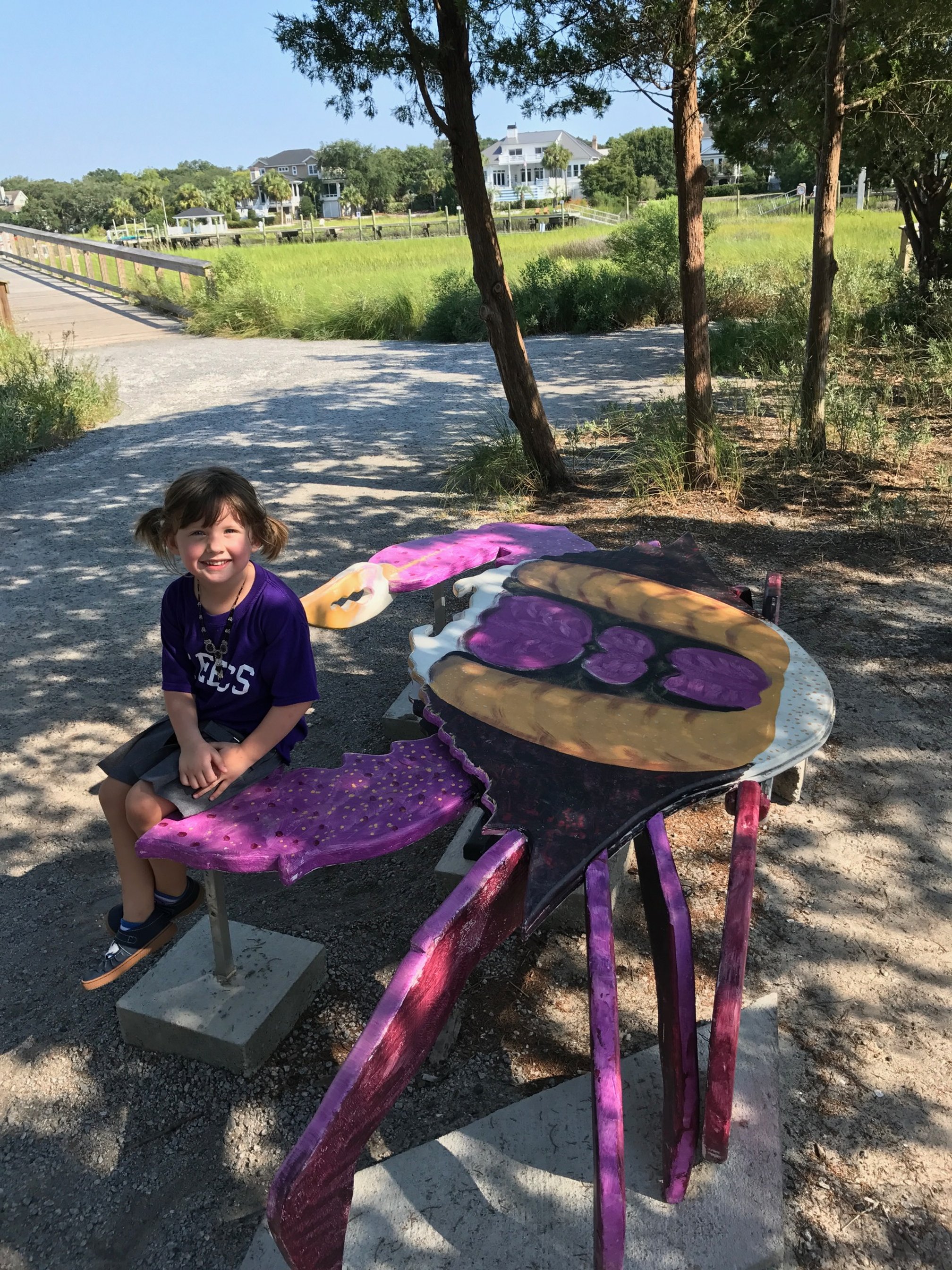
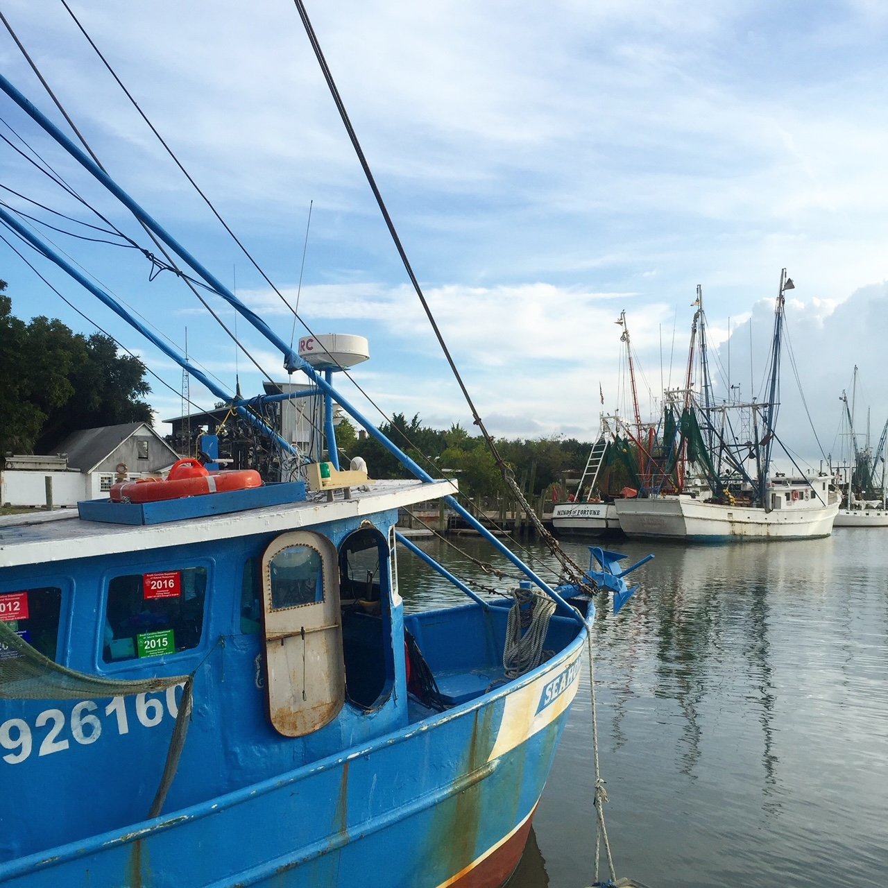
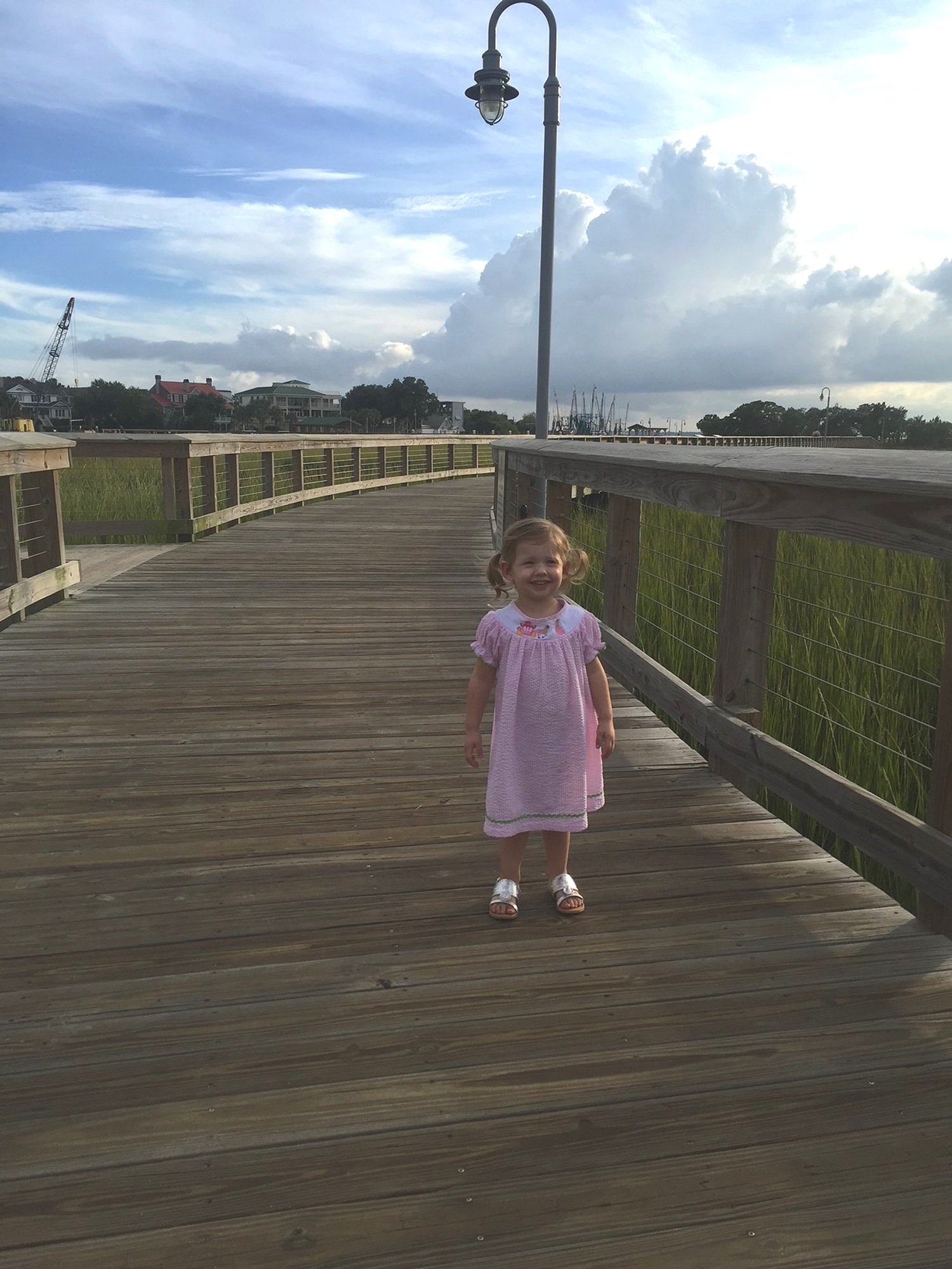
Shem Creek Park, Mount Pleasant
Location: The park is located on Shem Creek in Mount Pleasant. From downtown Charleston, take Highway 17 to Coleman Boulevard. The Shem Creek Park will be on your right before you get to the Shem Creek Bridge.
Parking: There is available parking in a coquina lot at the park’s entrance. Note that the park shares a larger lot with several businesses, including Vickery’s, Water’s Edge, and Mount Pleasant Seafood.
Cost: free
Length: 0.4 miles
Difficulty: easy
One of the most accessible hikes on this list, Shem Creek Park is a must-do for first time visitors to Charleston.
Shem Creek is the heart of seafood in Mount Pleasant, and you can watch shrimping and fishing boats come in and out each day.
Before this park was built, there wasn’t much direct creek access unless you were 1) taking a kayak tour, or 2) eating on a restaurant here.
The park opened up a much needed avenue for hiking in this area, and we now have wonderful creek views.
Most of the trail is along a wide boardwalk, though the path does dip into a crushed gravel section in the middle.
If you walk the entire length, you’ll be able to see the Charleston harbor. The final section of boardwalk has seating, so enjoy the view and ocean breezes for a bit before you make the return journey.
More adventures around Charleston:
Awendaw Passage of the Palmetto Trail, Awendaw
Location: The trailhead for the Awendaw Section of the Palmetto Trail is located at the end of 25 Mile Road. To get here, head north from downtown Charleston on Highway 17 for 30 miles, and turn right onto 25 mile road. You’ll see a small sign for the Awendaw Canoe Launch on Highway 17—turn here.
Parking: There is a small gravel parking lot at the trailhead. Parking is free.
Cost: free
Length: 9.3 mile out-and-back (part of the longer Palmetto Trail)
Difficulty: easy
You’re unlikely to run into many fellow hikers on this path, so you’ll have the forest tranquility to yourself.
At the trailhead is a small kayak launch, which is a great place to look out at the marsh.
For the remainder of this trail, you’ll have a great mixture of marsh views, pine forest, and oak trees to look at.
While most of the trail is relatively flat, there are a few areas where you’ll need to navigate gnarled tree roots.
When we lived in McClellanville just a few miles to the north, my husband would often run this trail. It’s peaceful, manageable for beginner hikers, and provides unspoiled Lowcountry beauty.
It’s definitely worth the drive from downtown Charleston or Mount Pleasant on a nice day.

Sunrise over the marsh on the Palmetto Trail
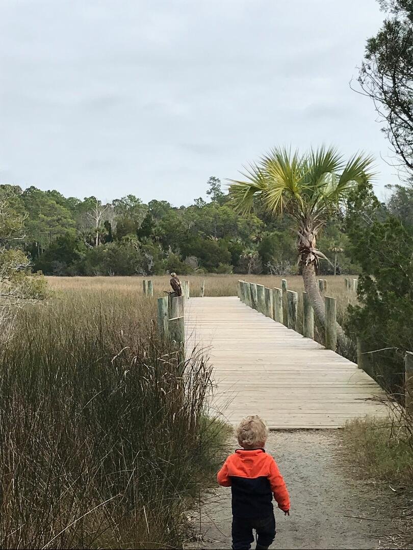
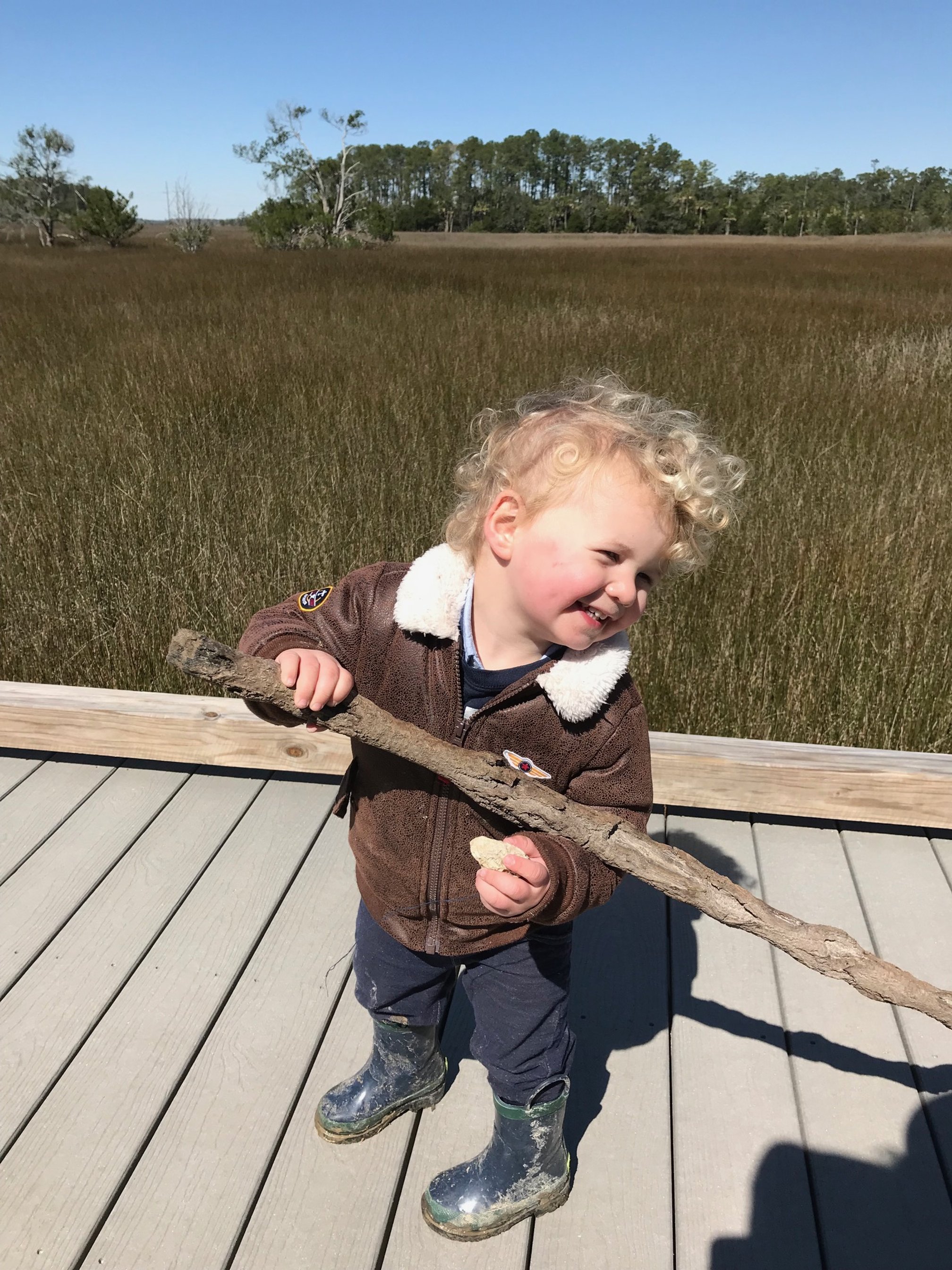
Red Wolf Trail, Sewee Visitors Center, Awendaw
Location: The Sewee Visitors Center is located on Highway 17 North in Awendaw, about 35 minutes from downtown Charleston.
Parking: Parking is free in the large lot in front of the center.
Cost: free
Length: 1 mile loop
Difficulty: easy

Sitting on the jawbone of a blue whale at the Sewee Visitors Center
When we lived in McClellanville, the Sewee Visitors Center was one of our favorite places to spend an afternoon.
The visitors center building has a small wildlife museum that your kids will enjoy.
Ask at the desk for the small educational booklet they can fill out.
Head out the back door to start the trail.
Your first stop will be at the red wolf enclosure, where the wolves are hopefully not sleeping!
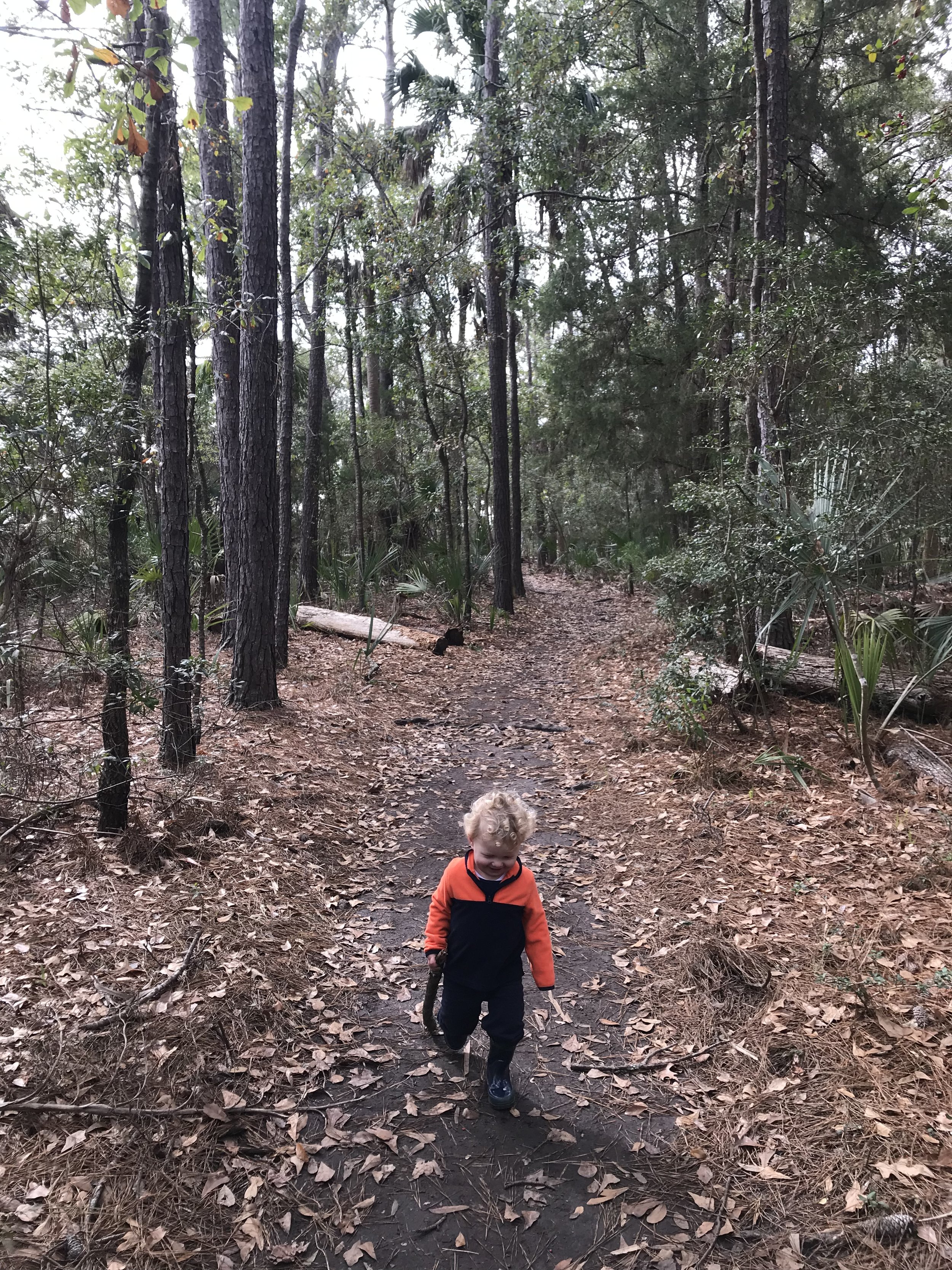
The rest of the 1 mile loop wanders through both swamp and pine forest.
Some of the trail has a boardwalk, while about half of it is dirt.
Look for the interpretive signs along the way to help you learn more about the animals and plants that make up this unique ecosystem.
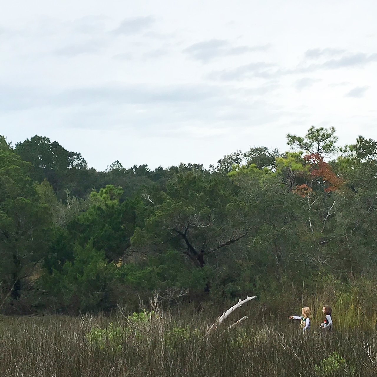
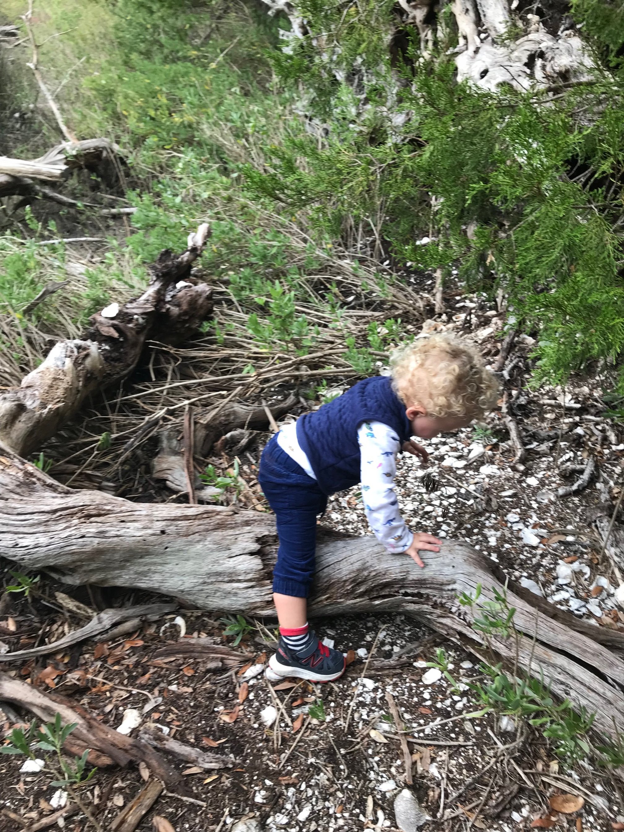
Sewee Shell Ring Trail, Awendaw
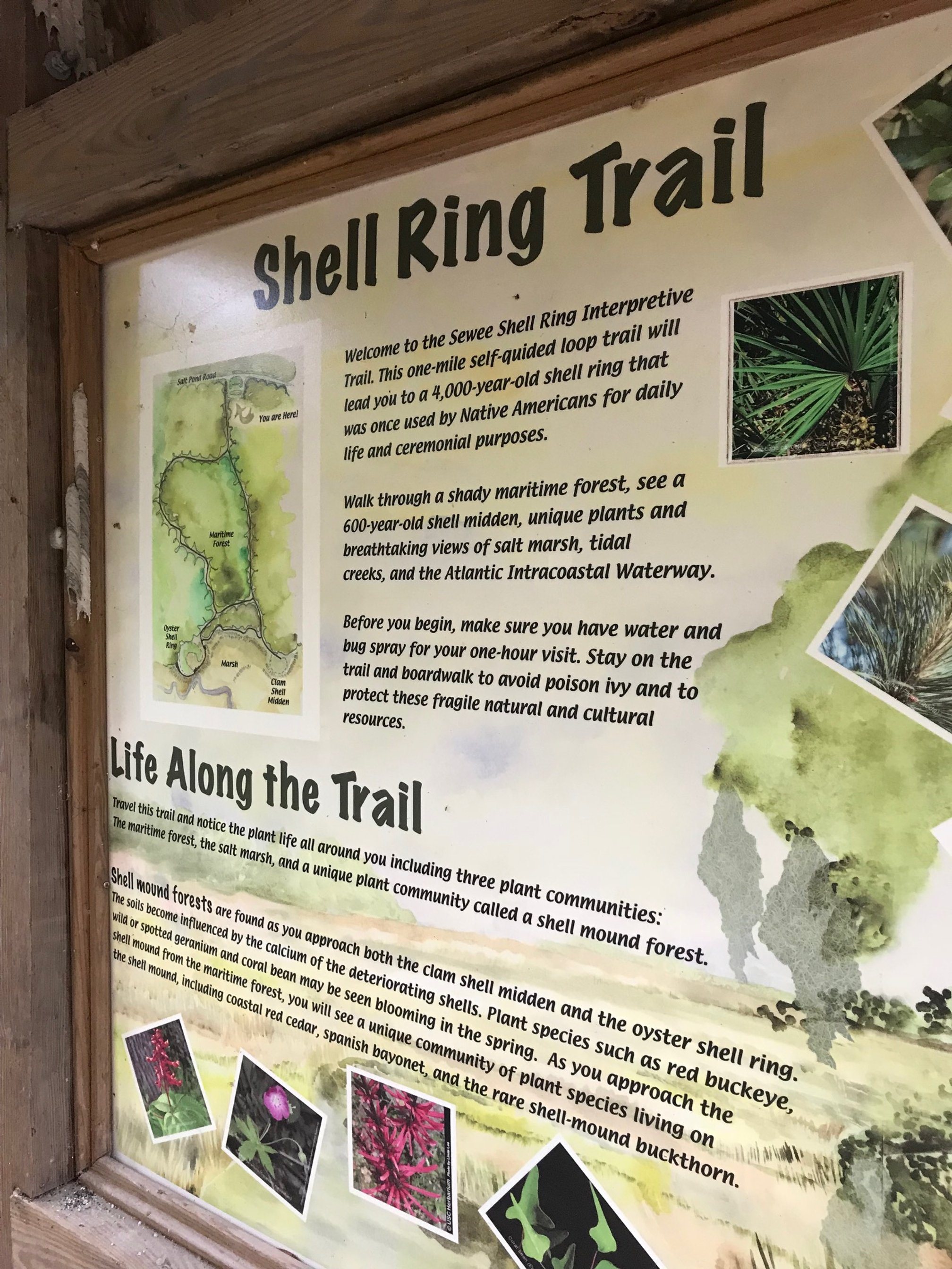
Location: The trailhead is located off of a forest road in Francis Marion National Forest. From downtown Charleston, take Highway 17 north for about 30 miles. When you see a sign for the Awendaw Town Hall, turn right onto Doar Road. Go down Doar Road for about 1.5 miles, then turn right onto Forest Service Road 243 (Gull Bay).
Parking: There are several spots in the crushed gravel lot at the trailhead. Parking is free.
Cost: free
Length: 1 mile loop
Difficulty: easy
This great 1 mile loop trail combines incredible views of the marsh with pre-European history.
Native Americans once inhabited this area and built an oyster shell ring. Archeologists and anthropologists aren’t completely sure what significance the shell ring had to the tribes, but it’s still fascinating to see.
You’ll start your hike next to the parking lot, where you will walk through a pine forest regardless of whether you head to the right or left.
While the path is unpaved, it is well marked and wide enough for two hikers to comfortably walk next to one another for most of the time.
Once you arrive at the marsh, you’ll see many, many oyster shells leading to the areas that compose the actual shell ring.
In the section of trail closest to the marsh, you’ll hike along a small boardwalk before returning to the pine forest on the second half of the loop.
NOTE: If you’re interested in visiting another of these shell middens, head down to Edisto Island, South Carolina, about an hour south of Charleston.
There’s one inside Edisto Beach State Park, one of our favorite South Carolina state parks for camping.
Bulls Island, Cape Romain National Wildlife Refuge

Meeting a local on Beach Road trail at Bulls Island
Location: Bulls Island is a barrier island off the coast of Awendaw, SC. It’s only accessible by boat, so you’ll need to take a tour from Coastal Expeditions (the island’s only outfitter) if you don’t have your own boat.
Parking: Parking is at Garris Ferry Landing in Awendaw. There is ample parking here, and it is free.
Cost: free to hike on the island, $55-75 for a day tour via Coastal Expeditions
Length: various
Difficulty: easy
If you’re looking for a truly unique hiking experience in Charleston, Bulls Island is your ticket.
This incredible barrier island will show you what Charleston used to look like before all of the development occurred—and it’s one of the few places in this area that is still wild.
The easiest hike, and the one that most visitors to the island do, is the 1/4 mile Beach Road hike.
This short hike bisects the island, and runs directly from the marsh at the back of the island to the beach area.
On summer days, the Beach Road hike is probably all you’ll want to do, especially when you see the unspoiled beach on the other end!
During cooler days, there are several other great areas to explore on island, which will allow you additional opportunities to see wildlife and the maritime forest.
Note: the wildlife is very, very wild here. We’ve had alligators and water moccasins essentially hang out while we had to get uncomfortably close to pass them.
If you’re planning to stay for an entire day—roughly 9 AM to 3 PM—you could tackle the entire northern end of the island via Old Fort Road and Lighthouse Road.
However, this loop route isn’t for younger kids, especially in the heat, as it clocks in at over 7 miles total.
See the Cape Romain hiking map for all of the combinations of hiking trails on the island.
Wambaw Creek Still Landing, McClellanville
Location: Take Highway 17 north from Charleston to McClellanville, and turn left at the blinking stop light in McClellanville onto Highway 45. After about 2 miles, turn right onto FS Road 211. When FS 211 forks, go left. Then, take an immediate left onto FS 211-B. The trailhead and landing are at the end of this road.
Parking: There are several spots near the landing. Parking is free.
Cost: Free
Length: approximately 0.5 mile
Difficulty: easy
Explore the peacefulness of the Francis Marion National Forest with this short, unnamed trail next to the Wambaw Creek Still Landing.
The trailhead begins in the parking lot to the left of the national forest information sign.
The small dirt path cuts through the underbrush at the top of the river bank.
This trail is an excellent way to explore Wambaw Creek and the black water swamps of coastal South Carolina without needing a kayak or canoe.
You’ll see beautiful ferns, the occasional snake, white-tailed deer, and a wide variety of birds along the trail.
The trail dead ends about half a mile into the forest, making this an easy add-on to your other hikes in the Awendaw and McClellanville areas.
Make this hike a full day out with a visit to the nearby Hampton Plantation State Historic Site, which has additional opportunities for nature hiking, a historic home tour, gardens to explore, and more.
Daniel Island Trail, Daniel Island

Location: Daniel Island is located on 526 between North Charleston and Mount Pleasant. After taking the Daniel Island exit, park at Governor’s Park underneath the interstate. There are a few trailheads, but the easiest to find is to the right of the back parking loop at Governor’s Park.
Parking: Parking is paved and ample. Parking is free.
Cost: Free
Length: 3 mile out and back
Difficulty: easy
This trail is always beautiful and clean, and it provides excellent views of the Wando River, marsh, and several ponds.
You’ll wind your way through a portion of the planned community on Daniel Island, where stately homes back up directly to the Wando River.
Most of the path is paved, though there are a few wooden boardwalks along the way.
This trail was one of my favorites to go on when my kids were little since I could push our stroller the entire way.
The trail eventually ends at Barfield Park, which is an excellent place for a picnic before you head back on the 1.5 mile return trip.
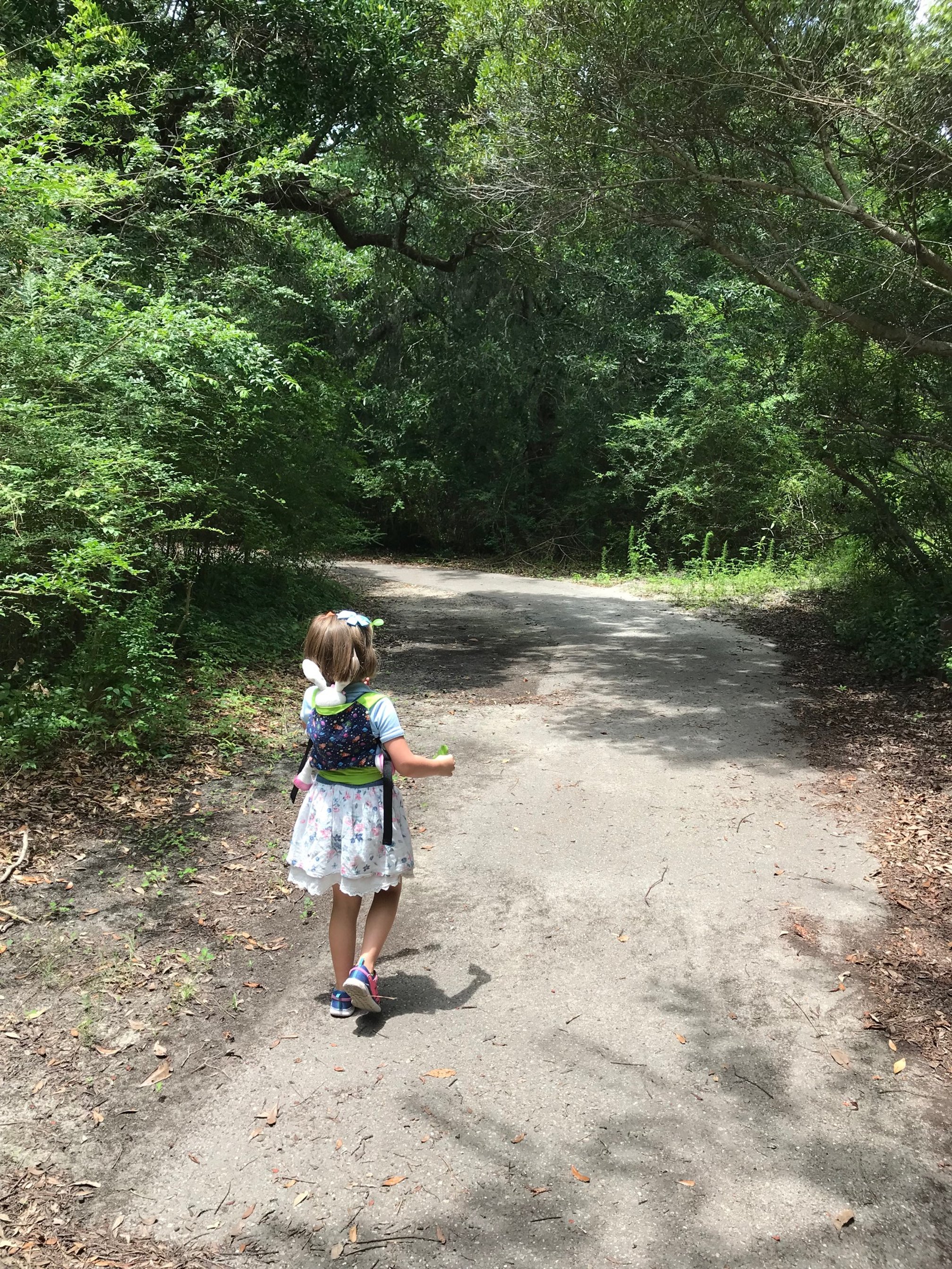
Palmetto Islands County Park, Mount Pleasant

Our daughter walks down the Bicycle Trail at Palmetto Islands County Park.
Location: Palmetto Islands County Park is located off of I-526 at the Long Point Road exit. The trailheads for the two suggested hikes below are both at the back of the parking area. Look for the Splash Island sign once you’re in the park and park close to that.
Parking: Parking is free. There is a large coquina lot to the left just past the toll booth.
Cost: $2 per person to enter the park
Length: 0
Difficulty:
Located off of Long Point Road in Mount Pleasant, this county park has several great trail that wind through palmetto trees, towering pines, and marshes.
While there are over 5 miles of trails throughout Palmetto Islands County Park, our favorites are the Bicycle Trail (1.1 miles one way), and the Nature Island Trail (1 mile one way).
The Bicycle Trail starts behind Splash Island, the county park’s small seasonal waterpark.
From there, you can walk along the paved path past the visitors center, the playground, and the 50-foot observation tower.
You’ll pass both fishing docks before the trail ends at the Peninsula Center, where there are snacks and restrooms.
Our other go-to hike at Palmetto Islands County Park is the Nature Island Trail, which heads away from the Splash Island parking lot and over a boardwalk.
Along the 1 mile hike, you might see eagles, snakes, lizards, whitetail deer, squirrels, hawks, or osprey.
This trail is unpaved but well maintained, making it appropriate for all ages and skill levels.
If you’d like to explore more after your hike, you can rent one of the paddleboats on the small pond for $5 (2-person) or $7 (4-person) per 30 minutes.
There are also inexpensive bike rentals at $5 per hour.
Rentals can be paid for at the park center near the parking lot.
Lighthouse Inlet Nature Preserve Trail, Folly Beach
Location: Take Ashley Avenue north on Folly Beach until the road ends at the stop sign and metal gate. The trailhead is past this gate or to the right of the sign depending on which path you’d like to follow.
Parking: Parking is available on Ashley Avenue for $2/hour.
Cost: $1 per person at the trailhead information board (honors system)
Length: 1.6 miles out and back
Difficulty: easy
This is a must do hike on your next Folly Beach vacation!
The Lighthouse Inlet Nature Preserve has 2 main paths that you can follow, one that goes down the old road, and another that mostly follows the beach.
I prefer the path following the old road as this is an area for local graffiti artists.
You’ll see all sorts of graffiti art on the road, and you can even bring your own can to tag.
Once you’re on the beach, you will be treated to unparalleled views of the Morris Island Lighthouse, which, thanks to erosion and a shifting coastline, is now permanently underwater.
This path is the best view you’ll get of the famed lighthouse until you take a boat tour to the actual sandbar next to the lighthouse.
Keep your eyes open on the beach—dolphins love to swim in Lighthouse Creek and the harbor.
Explore even more of South Carolina!
Sullivan's Island Nature Trail, Sullivan's Island
Location: Once you’re on Sullivan’s Island, turn right onto Middle Street and follow it until the fork in the road. Take the right fork, then park along Middle Street near Station 16. The trailhead is at the corner of Station 16 and Atlantic Avenue.
Parking: Parking is free along Middle Street, but read signs carefully as Sullivan’s Island police are quick to ticket people.
Cost: free
Length: 0.6 mile out and back
Difficulty: easy
Finding a quiet spot on Sullivan’s Island can be a daunting task now that it’s become a vacation destination.
This nature trail on the southern end of the island can be a bit tricky to find, especially for newcomers, but you’ll be rewarded for your efforts with a beach all to yourself.
The trailhead has a large wooden sign, and most of the trail is raised wooden boardwalk.
As you can imagine, the salt air is hard on the wooden boardwalk, so the trail can get uneven from time to time.
Watch for warped boards—this isn’t a great trail for strollers.
The trail ends at the beach, where you can see the Sullivan’s Island lighthouse, the Charleston harbor, and the Charleston skyline.
Walk up and down the beach before returning to your car, but don’t attempt to swim here. The currents are strong, and even more so when the container ships pass by.
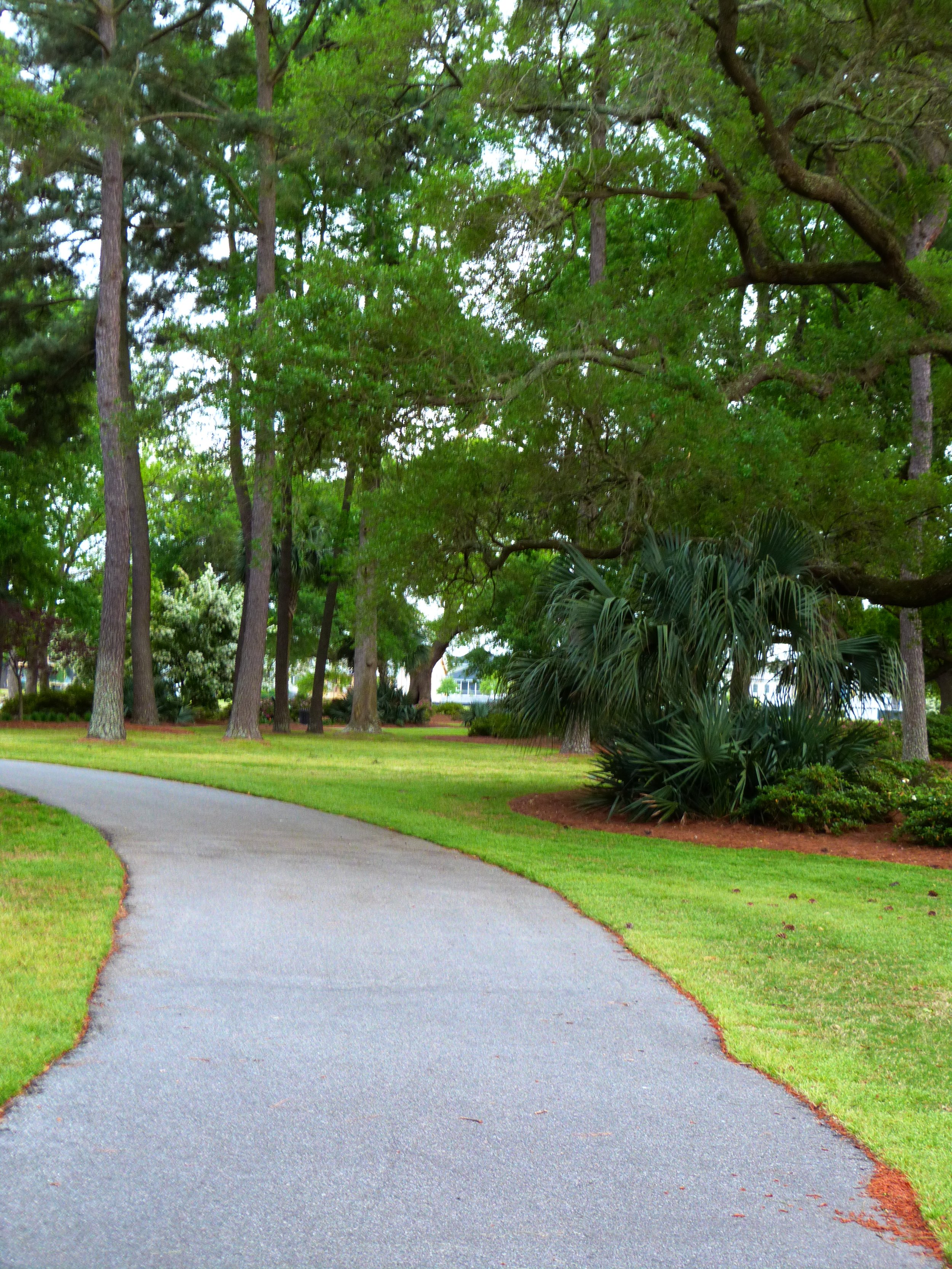
West Ashley Greenway, Charleston
Location: Runs from Albemarle Road near the circular Holiday Inn in West Ashley to McLeod Mill Road near the Stono River County Park
Parking: Park at one of the local businesses near the Albemarle Road or Folly Road trailheads, or at the designated parking lot at the trailhead on McLeod Mill Road.
Cost: free
Length: 10 miles out and back
Difficulty: easy
Much like the Swamp Rabbit trail, one of the best hikes in Greenville, the West Ashley Greenway connects many areas of the city with a pedestrian and biking path.
The trail parallels Highway 17 through West Ashley from Main Road to Albemarle Road.
This trail is very popular with locals, so you’ll see many people walking, biking, and running with their families and dogs.
Sections of the trail are paved, but there are also areas of packed dirt and wooden boardwalk and foot bridges.
Along the way, you’ll see live oak trees, marshes, and streams.
It’s not well lit at night, so I’d recommend going during the daytime for safety.
Pitt Street Bridge, Mount Pleasant

The trail overlooks the Intracoastal Waterway and Sullivans Island.
Location: The trailhead is at the southern end of Pitt Street in Mount Pleasant’s Old Village.
Parking: Parking is free near the trailhead. You can park along the sides of the road after you’re out of the residential area.
Cost: free
Length: 0.5 mile
Difficulty: easy
The Pitt Street Bridge Park is where I bring all of our out of town visitors!
It’s free, which is a great balance to Charleston’s many pricey activities, but it also offers incredible views of the Charleston harbor, the downtown skyline, Fort Sumter, James Island, and Sullivan’s Island.
The hike is fully paved and runs along an old railroad line, which originally took passengers to the beach across the Intracoastal Waterway and onto Sullivan’s Island.
Today, you can walk about halfway down the original bridge.
In addition to those beautiful views of the harbor and marsh, you’ll see fishermen reeling in their daily catch, people relaxing on the grassy areas, and kids playing.
I’d often take my kids here after school on a nice day, and we’d have a snack after we’d walked to the end of the bridge and back.
Note that there aren’t any amenities, so bring your own drinks and snacks.
There’s also not any shade along the path, and the Charleston sun and humidity can be brutal from April to October each year.
Head back down Pitt Street to the center of Old Village and treat yourself to a milkshake at Pitt Street Pharmacy when you’re done!

You can’t beat the views of Charleston from the Pitt Street Bridge!
Ravenel Bridge, Charleston
Location: It’s the giant bridge spanning the Charleston harbor between downtown and Mount Pleasant on Highway 17. You can’t miss it. :)
Parking: Parking is best on the Mount Pleasant side as downtown has had multiple car break-ins. There is plenty of parking under the bridge at the Mount Pleasant Waterfront Park.
Cost: free
Length: 5 miles out and back
Difficulty: intermediate
If you’re looking for some elevation on a Charleston hike, this is the only one in town!
It’s also a very popular activity for locals and visitors alike, especially on a nice day.
Starting on the Mount Pleasant side is recommended for 2 reasons:
1) the parking is safer here, and
2) the Mount Pleasant side of the bridge is much steeper.
Starting on the steep side means you’ll have a much easier go of it on the way back.
The walking and biking paths are on the harbor side of the bridge, which means you’ll be able to see Fort Sumter, James Island, the Morris Island Lighthouse, the Sullivan’s Island Lighthouse, and downtown Charleston on a clear day.
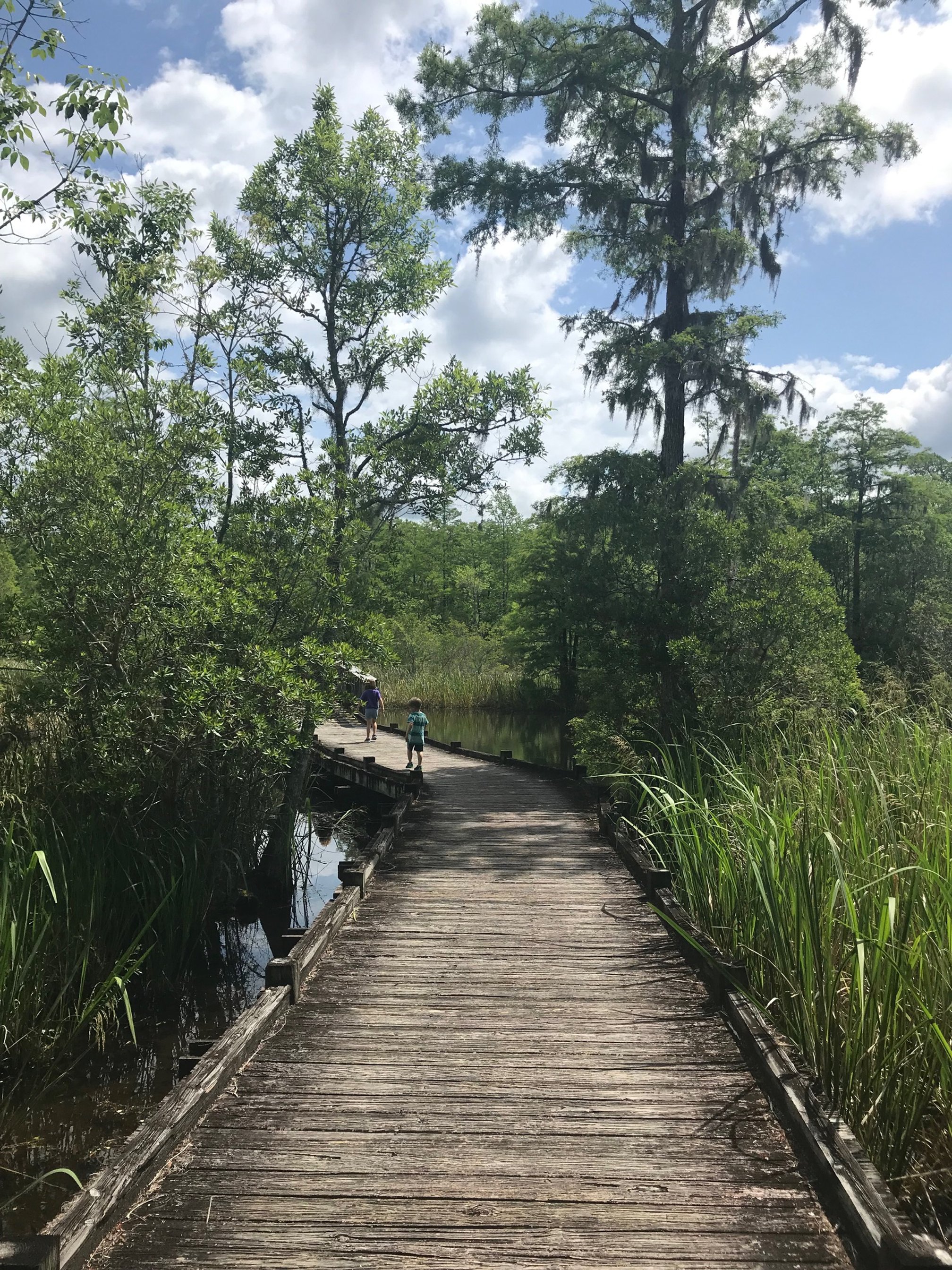
Alligator Loop, Old Santee Canal Park, Moncks Corner
Location: Old Santee Canal Park is located in Moncks Corner, South Carolina. The trailhead for the Alligator Loop is through the exit of the interpretive center.
Parking: Parking is free with park admission. There is ample parking at the interpretive center.
Cost: $5 per person to get into the park
Length: 0.5 miles
Difficulty: easy
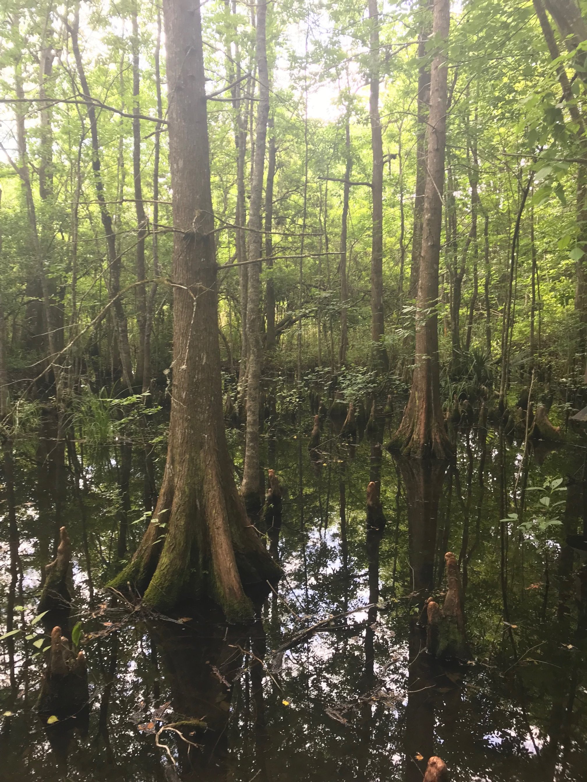
If you’re interested in the cypress swamps of Congaree National Park, but you don’t have time in your itinerary for a visit, Old Santee Canal Park is an excellent substitute.
Located less than an hour from downtown Charleston, Old Santee Canal Park is a wonderful day trip from the city.
There’s an small visitors center that your family should explore before heading out on the trail.
The Alligator Loop is only 0.5 mile, but its an up close look at all manner of Lowcountry wildlife, including turtles, dragonflies, lizards, fish, and (of course) alligators.
While these creatures are fascinating, you might not want to get too close to them, particularly the alligators, so the entire trail is a raised boardwalk.
The entire loop is well marked with red blazes.
If the Alligator Loop inspires you to look at more of the park, Old Santee Canal has more than 4 miles of boardwalk trails.
Hiking in Charleston FAQs
-
Charleston is a coastal town, and, as such, is flat and at sea level.
Hiking in Charleston doesn’t have much elevation change, but it does provide stunning views of the surrounding marsh, harbor, local wildlife and more.
-
All of the trails that I have listed above are great for the entire family.
However, if I had to pick 3 that are the most kid-friendly, I’d suggest Pitt Street Bridge, Old Santee Canal Park, and Shem Creek Park.
-
For the vast majority of the year, Charleston is humid and hot.
It is easy to get overheated and dehydrated here from March to October, so be prepared.
Bring more water than you think you’ll need and consistently drink it.
Many of these trails—including the Ravenel Bridge, Pitt Street Bridge, and parts of the West Ashley Greenway—have little to no cover.
Pack a hat and sunscreen to protect your skin.
I also strongly recommend bug spray before heading out on the forest trails such as Sewee Shell Ring Trail, the Awendaw Passage, Old Santee Canal Park, and Laurel Hill County Park. The mosquitos and no-see-ums can be brutal during the warmer months.